Definition
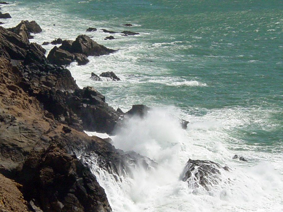
A coastal erosional and depositional landform is any feature along a shoreline shaped primarily by the repeated action of waves, tides, and currents wearing away exposed rock in one stretch of coast and depositing the resulting sediment somewhere else. The same processes that cut cliffs, caves, arches, and sea stacks out of resistant rock are also busy building beaches, spits, and barrier islands out of the sand and gravel those processes produce. Because erosion and deposition work together along almost every shoreline, a single stretch of coast often shows both kinds of landform within sight of each other: a rocky headland being cut back by waves on one side of a bay, and a crescent of sand quietly growing on the other.
How It Forms
Coastal erosion rarely wears a shoreline down evenly. Differences in rock hardness, wave exposure, and the angle at which waves strike the shore cause some sections of coast to erode quickly while neighboring sections barely change, and the sediment removed from the fast-eroding sections has to go somewhere. The landforms described here develop through a connected sequence of erosion, transport, and deposition that plays out differently at every coastline but follows the same basic logic almost everywhere.
- Waves erode unevenly along the shore.
Waves break with the most force against points of land that jut into the sea, called headlands, while energy dissipates in the sheltered bays between them. Headlands are usually made of more resistant rock, which is why they still stick out; softer rock nearby has already eroded into the bays flanking them. This uneven attack, known as differential erosion, is the starting point for most erosional coastal landforms.
- Headlands are undercut into caves, arches, and stacks.
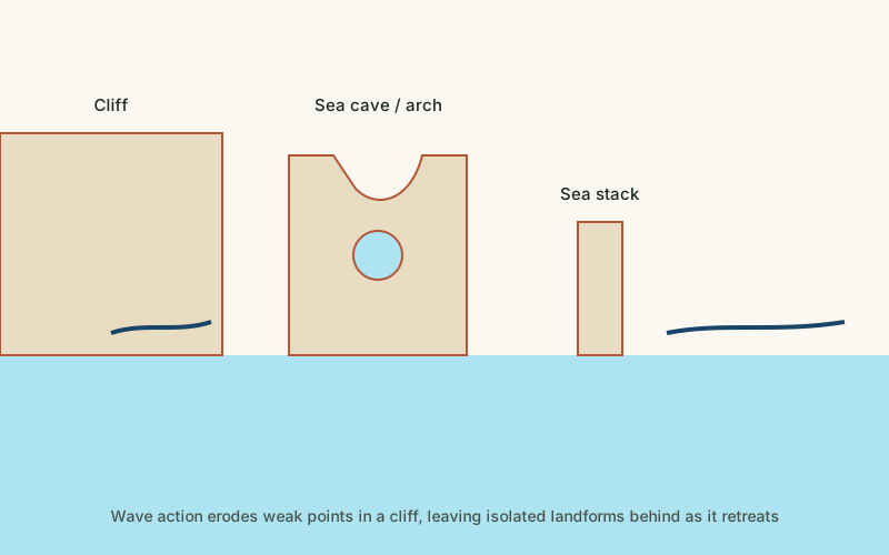
Waves exploit cracks, joints, and weaker bands of rock in a headland, hollowing out sea caves at the waterline. Where a cave cuts all the way through a narrow headland, it becomes an arch. Continued erosion eventually collapses the arch's roof, leaving an isolated pillar of rock, called a sea stack, standing apart from the retreating cliff line behind it.
- Loosened sediment travels along the coast.
Sand, gravel, and finer rock debris produced by erosion rarely stay where they were created. Waves approaching at an angle generate a current that runs parallel to the shore, known as longshore drift, which carries loose sediment steadily along the coastline, sometimes for many kilometers, before it finally settles.
- Deposited sediment builds new land.
Where the coastline changes direction or the current loses energy, carried sediment drops out and accumulates. Over time this builds beaches, elongated ridges called spits that extend from the shore across a bay or river mouth, and, in some locations, barrier islands separated from the mainland by a lagoon. These depositional landforms are just as much a product of coastal erosion as the cliffs and stacks eroding elsewhere on the same coast.
Formation Timescale
How quickly a given stretch of coast changes depends enormously on the rock it is made of and how exposed it is to large waves and storms. Cliffs cut into soft clay or glacial till can retreat several meters in a single severe storm, while cliffs of resistant chalk, limestone, or granite may take centuries to retreat by the same amount. Depositional features like spits and barrier islands can also shift position noticeably within a human lifetime, especially after major storms. Because of this range, coastal landforms are usually described as forming over a medium timescale of decades to centuries, but this figure varies enormously from site to site and should be treated as a general guide rather than a fixed rule.
Main Characteristics
- Differential erosion: harder rock resists longer, so headlands and resistant points persist while softer rock erodes into bays.
- Paired erosional and depositional features: most coastlines show both cliffs or stacks being cut back and beaches or spits being built up, often close together.
- Constant reshaping: coastal landforms are among the most actively changing features on this site, sometimes visibly altered within a single storm season.
- Wave energy concentration: headlands receive focused wave energy from multiple directions, accelerating their erosion compared with sheltered bays.
- Sediment transport pathways: many depositional landforms only exist because sediment eroded elsewhere was carried to them by longshore currents.
Materials and Structures Involved
The rock exposed along an eroding coastline strongly influences how fast and in what shape it erodes. Soft, uniform rock such as clay, shale, or unconsolidated glacial till erodes rapidly and tends to produce smoothly retreating cliffs rather than dramatic arches or stacks, since it rarely holds a shape long enough. Harder, more resistant rock such as chalk, limestone, granite, or basalt erodes far more slowly and is far more likely to be left behind as isolated arches, stacks, and headlands while weaker surrounding rock disappears. The sediment produced by this erosion, and later deposited elsewhere, ranges from fine sand built mostly of quartz grains to coarse gravel and cobbles, depending on the strength of the source rock and the energy of the waves and currents moving it.
Climates and Environments
Coastal erosion landforms occur wherever land meets open water, but the rate and style of erosion vary with climate and exposure. Shorelines facing long stretches of open ocean, with no islands or shallow water to absorb wave energy before it arrives, tend to erode faster than sheltered coasts. Storm frequency and intensity, tidal range, and the direction prevailing winds blow from all shape how quickly a given coastline changes, and rising sea levels are now increasing erosion rates along many coasts worldwide by pushing wave action further inland and removing protective beach sediment.
Real Examples
The Twelve Apostles along Australia's southern coast are a series of limestone sea stacks left standing after the arches and headlands that once connected them to the mainland collapsed, a process still ongoing today. The White Cliffs of Dover in southern England expose soft chalk that continues to retreat through rockfalls undercut by wave action at the base of the cliff. Cape Hatteras on the Outer Banks of North America sits on a barrier island built almost entirely from sediment carried and deposited by longshore currents, and continues to shift position in response to storms. Durdle Door in England is a natural arch cut through a limestone headland, illustrating the intermediate stage between an intact headland and an isolated sea stack.
How It Continues to Change
Coastal landforms rarely stay the same for long. Storms can remove or deposit more sediment in a single event than typically moves in years of calmer weather, and a severe storm can collapse an arch, create a new stack, or wash away a spit that took decades to build. Rising sea levels are accelerating erosion along many coastlines by allowing waves to reach further inland and by reducing the width of protective beaches, while coastal engineering such as seawalls and groins can slow erosion in one location only to starve neighboring beaches of the sediment they depend on.
How It Differs From Similar Formations
Coastal erosion landforms are closely related to, but distinct from, coastal cliffs, which focus specifically on the retreat of a single steep rock face rather than the full range of erosional and depositional shapes a coastline can produce. They are also related to natural arches, since sea arches form by the same undercutting mechanism as desert arches but are cut by waves rather than wind and occasional flash flooding, and they tend to collapse much faster because of the constant wave action at their base.
Common Misconceptions
Misconception: Coastal erosion only destroys land.
Reality: Erosion and deposition are two sides of the same process. Sediment removed from eroding cliffs and headlands is carried elsewhere along the coast and deposited as new beaches, spits, and barrier islands.
Misconception: A coastline shown on a map is a fixed, permanent boundary.
Reality: Coastlines are among the most actively changing landforms on Earth. Many shift noticeably within a human lifetime, and some change visibly after a single large storm.
Misconception: Sea arches and stacks are rare, one-off formations.
Reality: They are a predictable stage in a repeating sequence, cave, then arch, then stack, then disappearance, that plays out continually wherever resistant headlands meet erosive wave action.
Key Terms
- Abrasion — The wearing away of rock surfaces by friction, as sediment carried by ice, water, or wind scrapes against bedrock.
- Erosion — The wearing away and removal of rock, soil, or sediment by natural forces such as water, wind, or ice.
- Deposition — The process by which sediment carried by wind, water, or ice is laid down and accumulates in a new location.
- Sediment — Solid material — fragments of rock, mineral grains, or organic matter — that is transported and deposited by water, wind, or ice.
- Escarpment — A steep slope or cliff that marks a sharp change in elevation, often separating two relatively flat areas.
- Dune — A mound or ridge of sand built up by wind, typically found in deserts and along coastlines.