Landscape Explorer

Combine filters to find formations by what shaped them, where they occur, and how long they take to form.

Clear filters

0 filters active · 30 results.

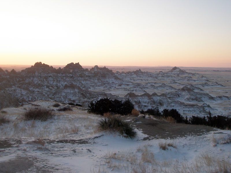
The Big Badlands in early morning winter light, Badlands National Park.
Badlands Erosion

How Badlands Are Formed

Badlands form where soft, sparsely vegetated sedimentary rock is carved rapidly by intense, infrequent rainstorms into dense networks of ridges and gullies.

Examples: Badlands National Park (South Dakota, USA), Drumheller Badlands (Alberta, Canada)

Formation timescale: Short (decades to centuries)

Read the full article →
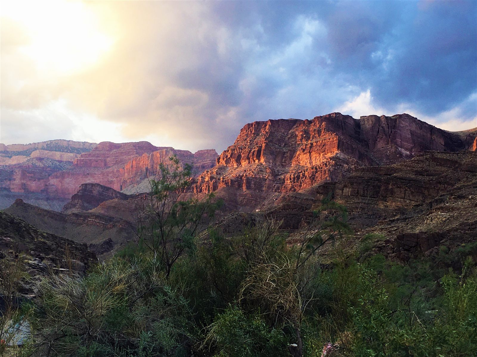
Sunset light on the layered canyon walls of the Grand Canyon, with riparian trees in the foreground.
Canyon River Activity

How Canyons Are Carved

A canyon is a deep, narrow valley with steep walls, usually cut by a river into rock that is being slowly raised by tectonic forces.

Examples: Grand Canyon (North America), Fish River Canyon (Africa)

Formation timescale: Very Long (millions of years)

Read the full article →
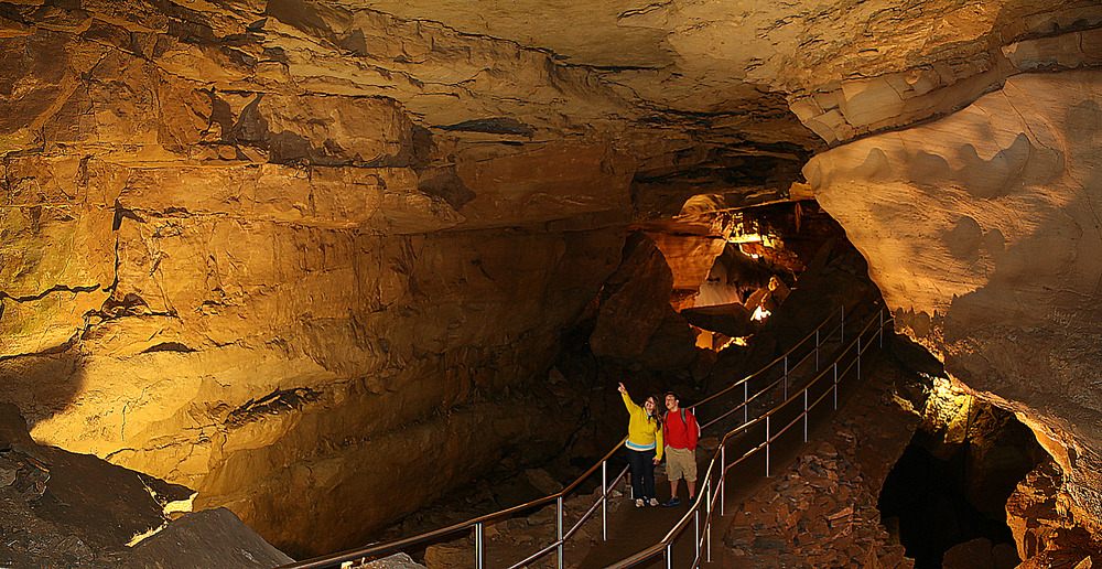
Visitors on a walkway through a passage in Mammoth Cave.
Cave & Cavern Chemical Weathering

How Caves and Caverns Develop

Most large caves form when slightly acidic water slowly dissolves soluble rock, usually limestone, carving out underground passages over thousands of years.

Examples: Mammoth Cave (North America), Carlsbad Caverns (North America)

Formation timescale: Long (hundreds of thousands of years)

Read the full article →
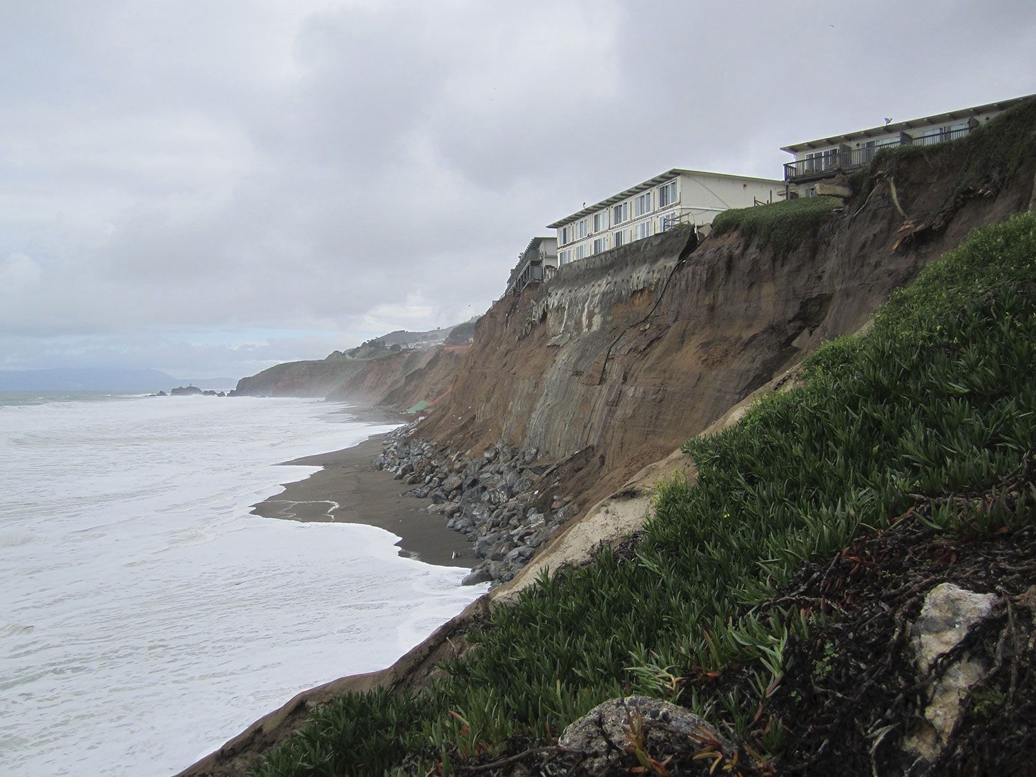
An eroding coastal cliff beneath apartment buildings in Pacifica, California.
Coastal Cliff Coastal Activity

How Coastal Cliffs Develop

Coastal cliffs form where waves undercut and weather exposed rock faster than it can be removed by gentler processes, leaving a steep edge that slowly retreats inland.

Examples: Cliffs of Moher (Europe), Seven Sisters (Europe)

Formation timescale: Medium (thousands of years)

Read the full article →
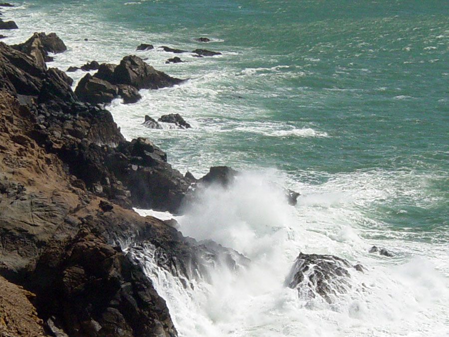
Sea stacks and wave-eroded cliffs at Point Reyes, California.
Coastal Landform Coastal Activity

How Coastal Erosion Creates New Landforms

Coastal erosion wears away exposed rock into cliffs, arches, and sea stacks, while the sediment it produces is carried along the shore to build new beaches, spits, and barrier islands elsewhere.

Examples: The Twelve Apostles (Australia), The White Cliffs of Dover (Europe)

Formation timescale: Medium (thousands of years)

Read the full article →
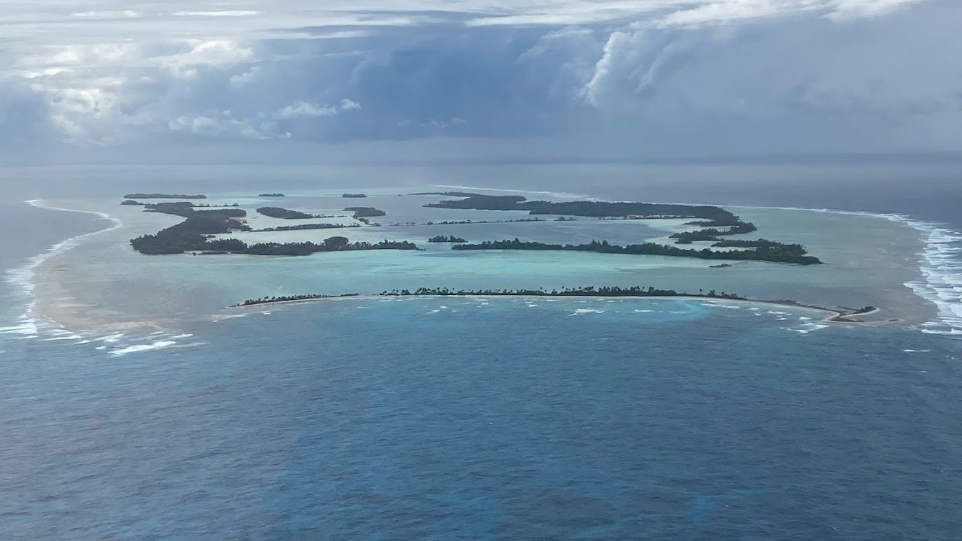
Aerial view of the forested coral atoll of Palmyra, surrounded by ocean.
Coral Atoll Coastal Activity

How Coral Atolls Develop

A coral atoll forms when a fringing coral reef continues growing upward around a volcanic island that is slowly subsiding, eventually leaving only a ring of reef and low islands once the volcano sinks below the surface.

Examples: Bikini Atoll (Oceania), Maldives Atolls (Asia)

Formation timescale: Very Long (millions of years)

Read the full article →
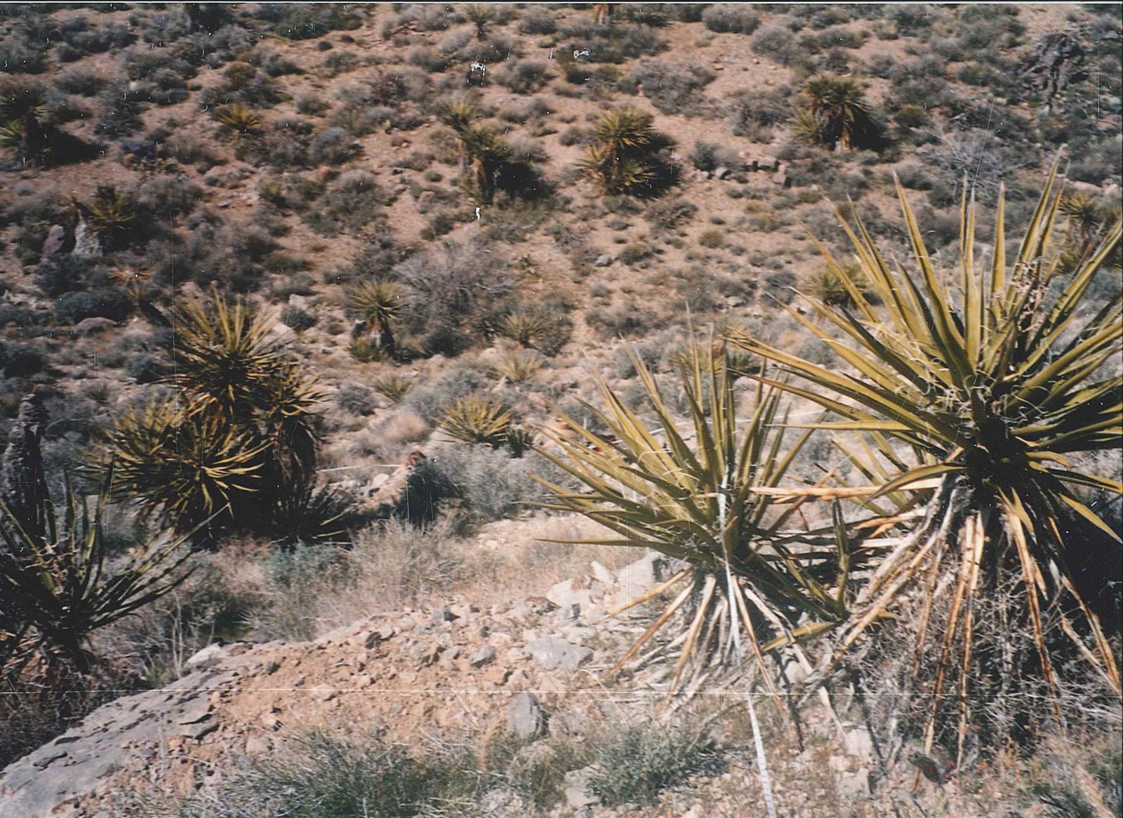
Vegetation and topography of the central Mojave Desert.
Desert Erosion

How Deserts Form

A desert forms wherever a region consistently receives very little precipitation, whether because of global air circulation patterns, distance from oceans, or the rain-blocking effect of mountains.

Examples: Sahara Desert (Africa), Atacama Desert (South America)

Formation timescale: Long (hundreds of thousands of years)

Read the full article →
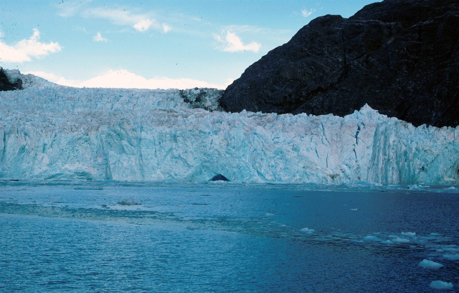
Muir Inlet and the tidewater terminus of Muir Glacier in Glacier Bay, Alaska.
Fjord Glacial Activity

How Fjords Are Created

Fjords are deep, steep-walled coastal inlets carved by glaciers during past ice ages and later flooded by rising seas, leaving some of the most dramatic coastlines on Earth.

Examples: Sognefjord (Norway), Milford Sound (New Zealand)

Formation timescale: Very Long (millions of years)

Read the full article →
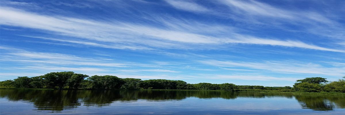
Backwater floodplain forest along the Upper Mississippi River.
Floodplain River Activity

How Floodplains Develop

A floodplain is the low-lying land bordering a river that is periodically covered by overflowing water, which deposits fresh sediment and gradually builds up the surrounding ground.

Examples: Amazon Floodplain (South America), Nile Floodplain (Africa)

Formation timescale: Short (decades to centuries)

Read the full article →
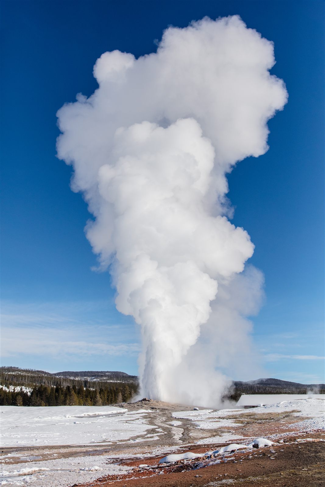
Old Faithful Geyser erupting on a clear winter day in Yellowstone National Park.
Geyser & Hot Spring Volcanic Activity

How Geysers and Hot Springs Work

Geysers and hot springs form where groundwater is heated by volcanic activity close to the surface; only a rare few develop the underground plumbing needed to erupt on a cycle.

Examples: Old Faithful (Yellowstone, USA), Geysir (Iceland)

Formation timescale: Rapid (hours to years)

Read the full article →
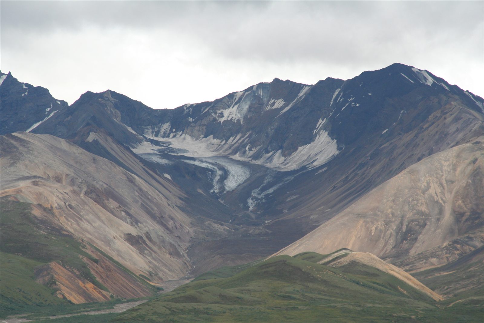
A retreating glacier viewed from Polychrome Mountain in Denali National Park, Alaska.
Glacier Glacial Activity

How Glaciers Shape the Landscape

Glaciers are slow-moving rivers of ice that erode mountains into sharp ridges and carve valleys into broad troughs, while depositing the debris they carry along the way.

Examples: Perito Moreno Glacier (South America), Jakobshavn Glacier (Greenland, North America)

Formation timescale: Long (hundreds of thousands of years)

Read the full article →
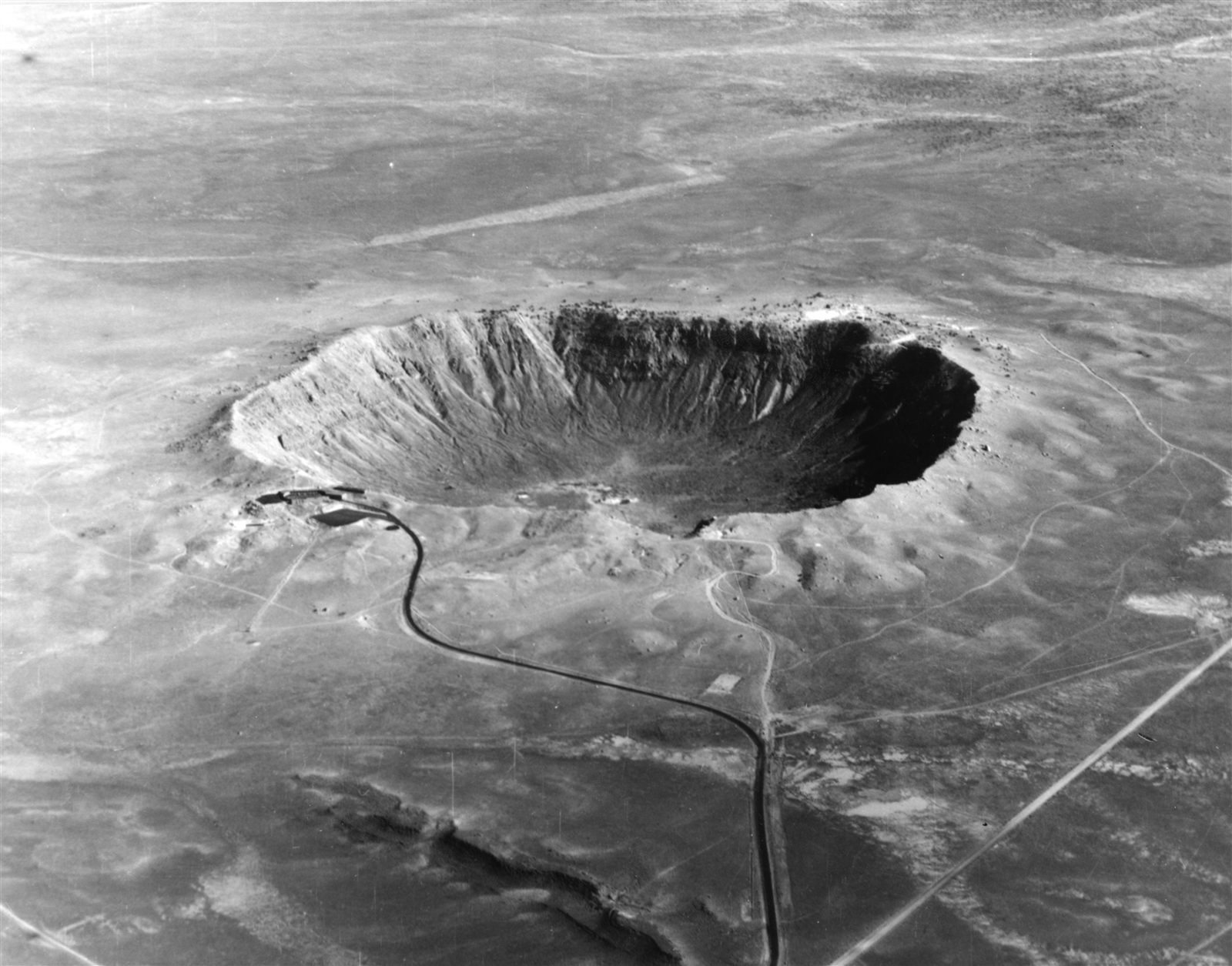
Aerial view of Meteor Crater, a bowl-shaped impact crater in northern Arizona.
Impact Crater Meteorite Impact

How Impact Craters Are Created

Impact craters form almost instantly when a meteoroid, asteroid, or comet strikes a planetary surface at extremely high speed, excavating a circular depression far larger than the object itself.

Examples: Meteor Crater (Arizona, USA), Vredefort Dome (South Africa)

Formation timescale: Rapid (hours to years)

Read the full article →
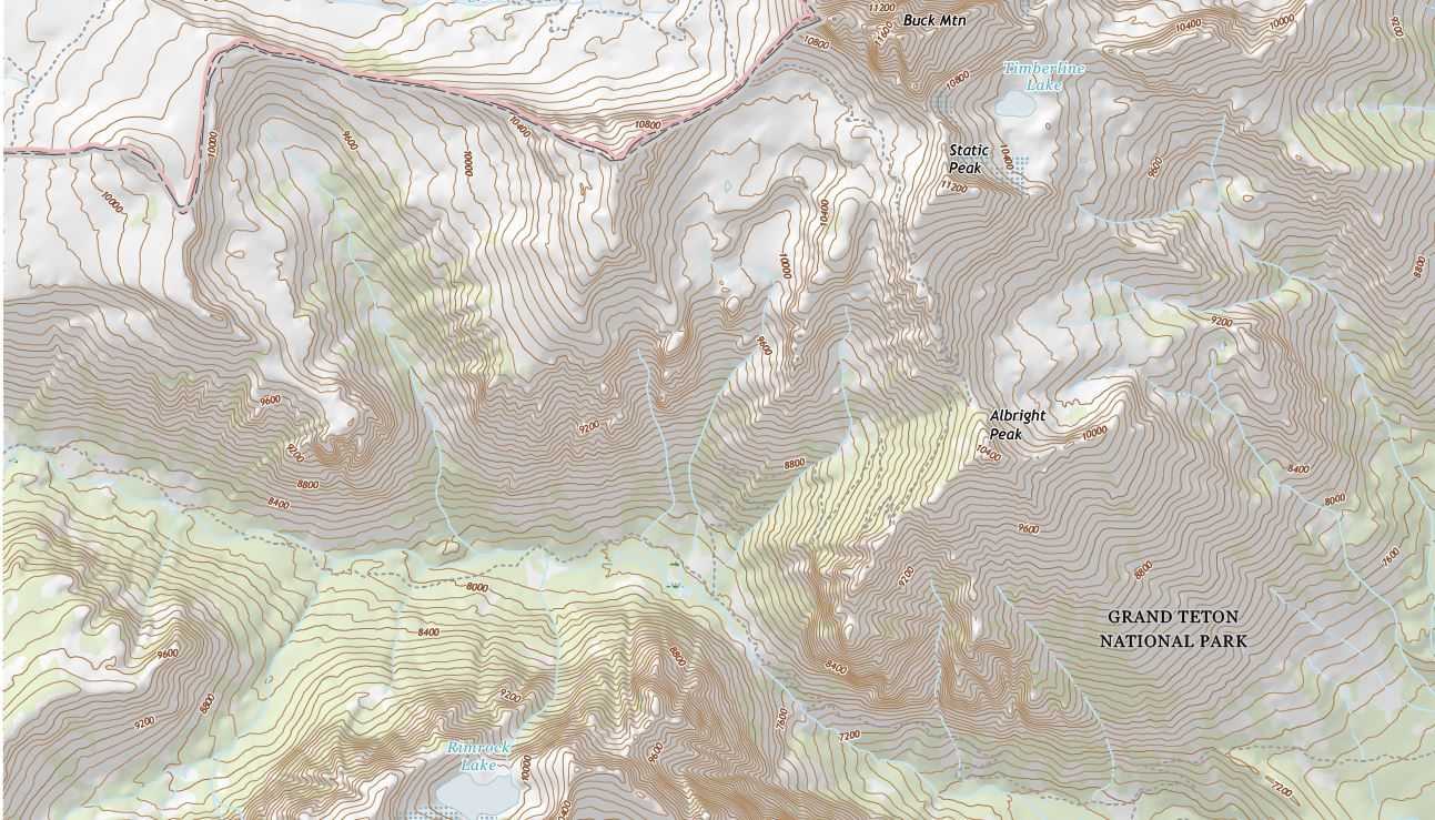
A portion of the 2017 US Topo map of Grand Teton, Wyoming, shown with shaded relief.
Cartographic Concept

How Maps Represent Elevation and Relief

Maps use contour lines, color elevation scales, and shaded relief to represent the three-dimensional shape of the land on a flat surface, letting a reader judge height, slope, and landform shape at a glance.

Examples: USGS topographic quadrangle maps (United States), NOAA nautical bathymetric charts

Read the full article →
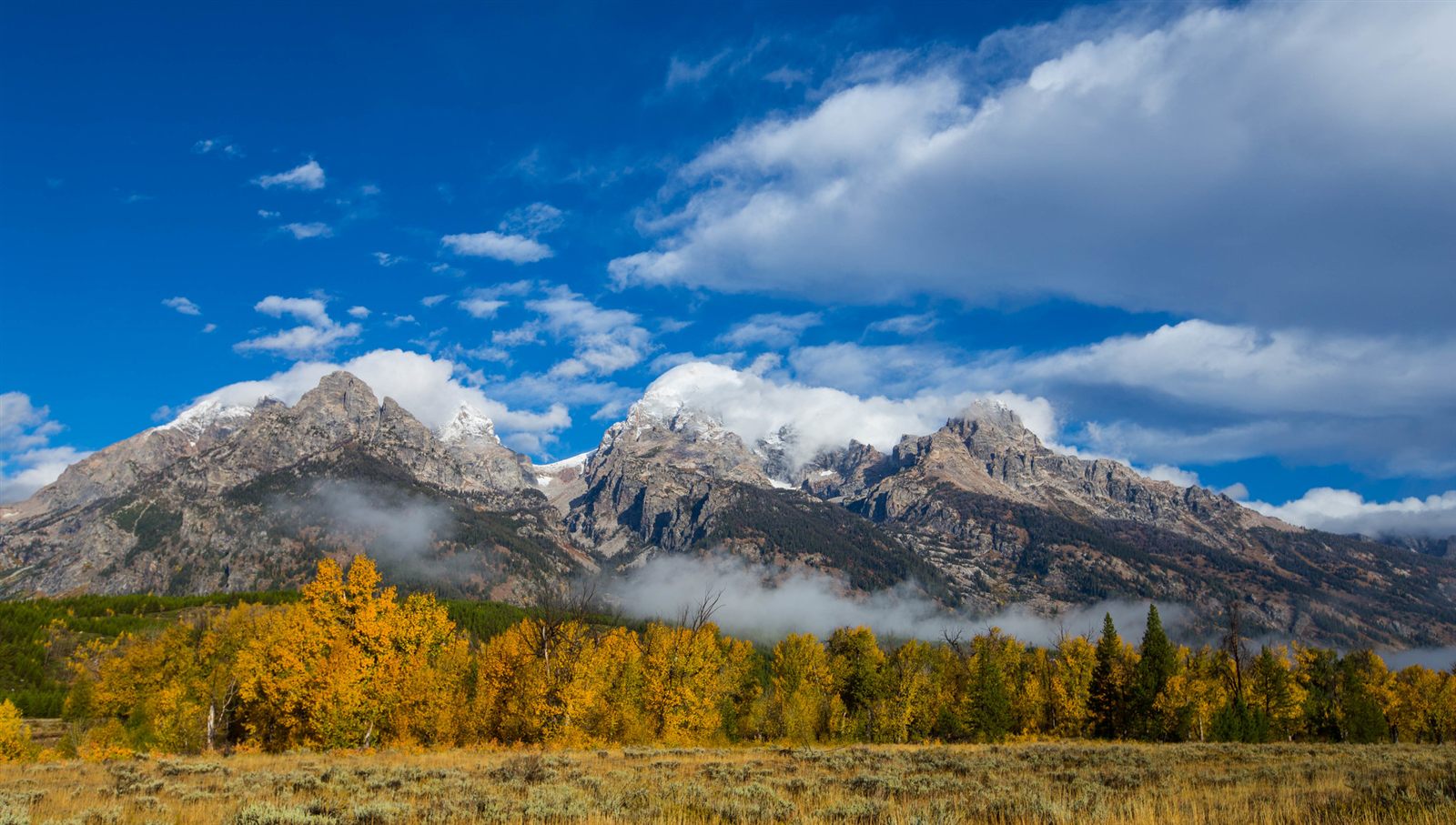
Grand Teton rising above its surrounding range in Grand Teton National Park, Wyoming.
Mountain Tectonic Activity

How Mountains Form

Most of the world's great mountain ranges were raised by the slow collision of tectonic plates, then sculpted into peaks and ridges by ice, water, and wind.

Examples: Himalayas (Asia), Andes (South America)

Formation timescale: Very Long (millions of years)

Read the full article →
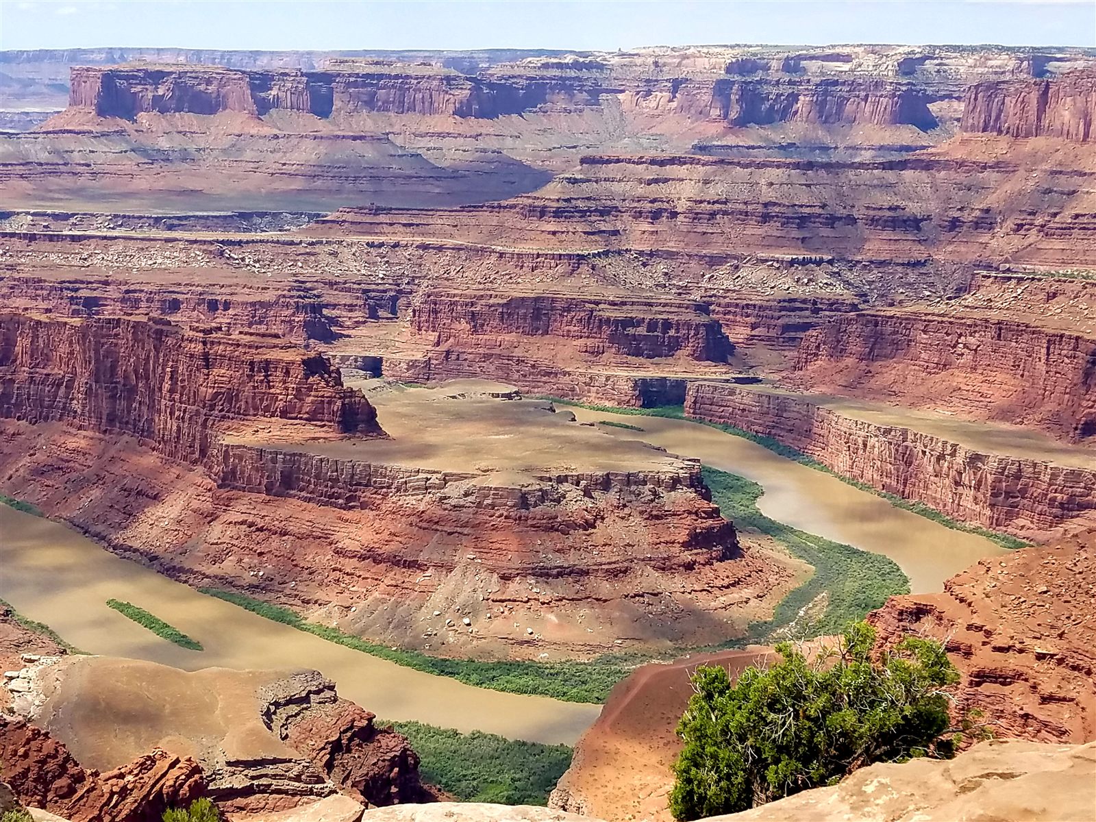
Horizontal sedimentary rock layers of the Colorado Plateau at Dead Horse Point, Utah.
Plateau Tectonic Activity

How Plateaus Form

A plateau is a broad, elevated area of relatively flat land, raised largely intact by tectonic uplift or built up from repeated layers of volcanic rock.

Examples: Colorado Plateau (North America), Tibetan Plateau (Asia)

Formation timescale: Very Long (millions of years)

Read the full article →
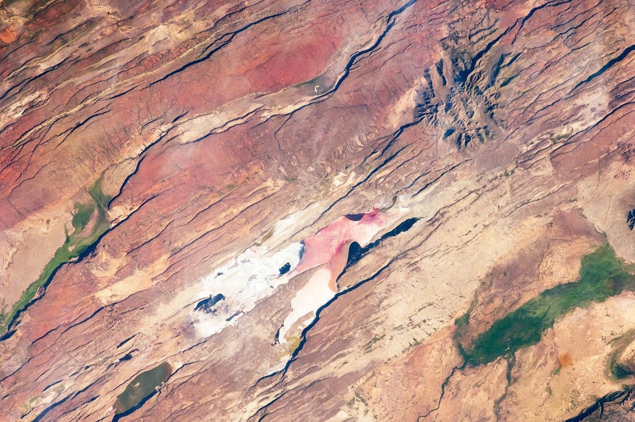
Astronaut photograph of the East African Rift near Kenya's southern border.
Rift Valley Tectonic Activity

How Rift Valleys Are Created

A rift valley forms where tectonic plates pull apart, stretching and thinning the crust until a section of it drops down between parallel fault lines.

Examples: East African Rift (Africa), Rhine Rift Valley (Europe)

Formation timescale: Very Long (millions of years)

Read the full article →
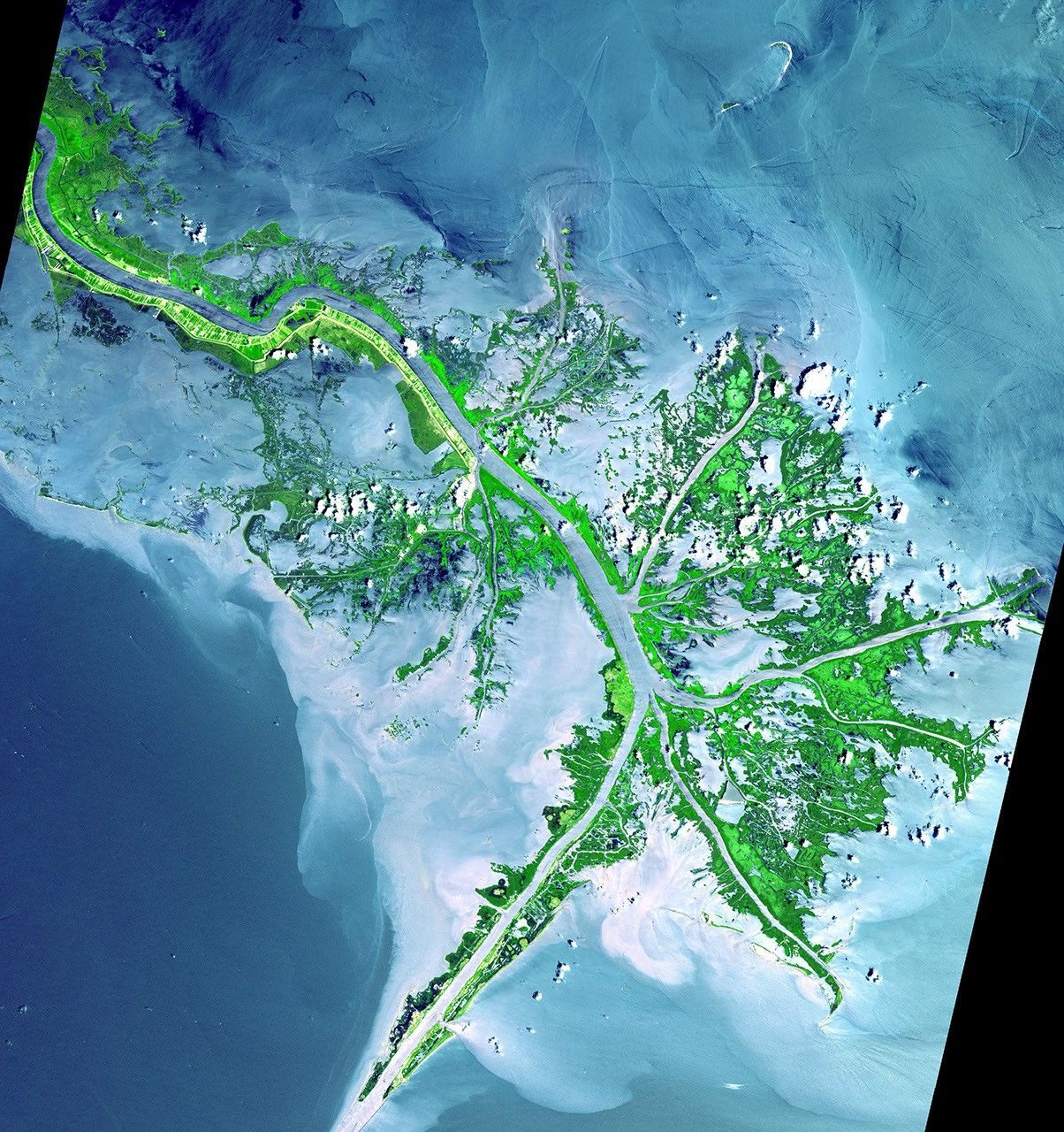
False-color satellite image of sediment spreading from the Mississippi River delta into the Gulf of Mexico.
River Delta Deposition

How River Deltas Develop

A river delta forms where a river slows down and spreads out as it meets a sea, lake, or ocean, dropping the sediment it has carried and gradually building new land.

Examples: Mississippi River Delta (North America), Nile Delta (Africa)

Formation timescale: Medium (thousands of years)

Read the full article →
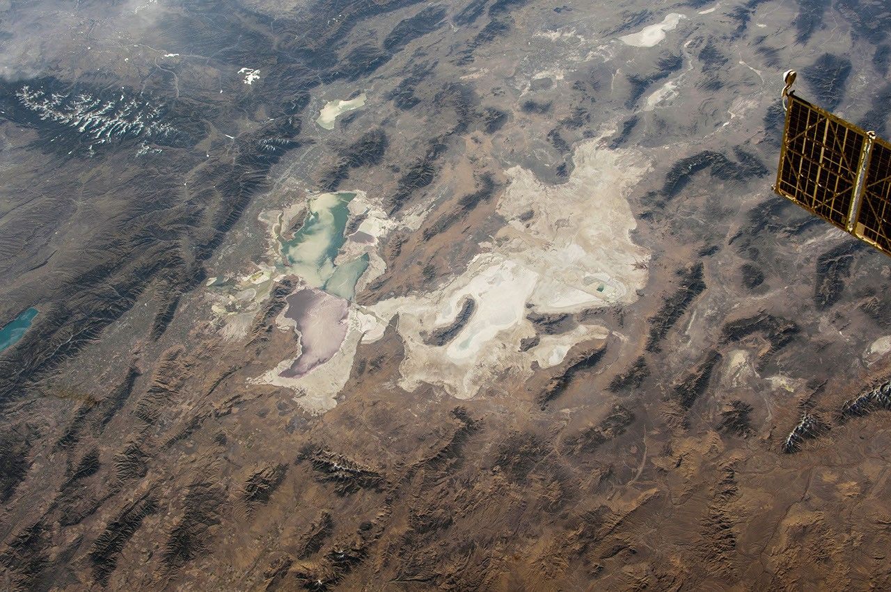
Astronaut photograph of the Bonneville Salt Flats in northeast Utah.
Salt Flat Deposition

How Salt Flats Develop

Salt flats form when water collecting in a closed desert basin evaporates repeatedly, leaving behind thick layers of crystallized mineral salts.

Examples: Salar de Uyuni (Bolivia), Bonneville Salt Flats (Utah, USA)

Formation timescale: Medium (thousands of years)

Read the full article →
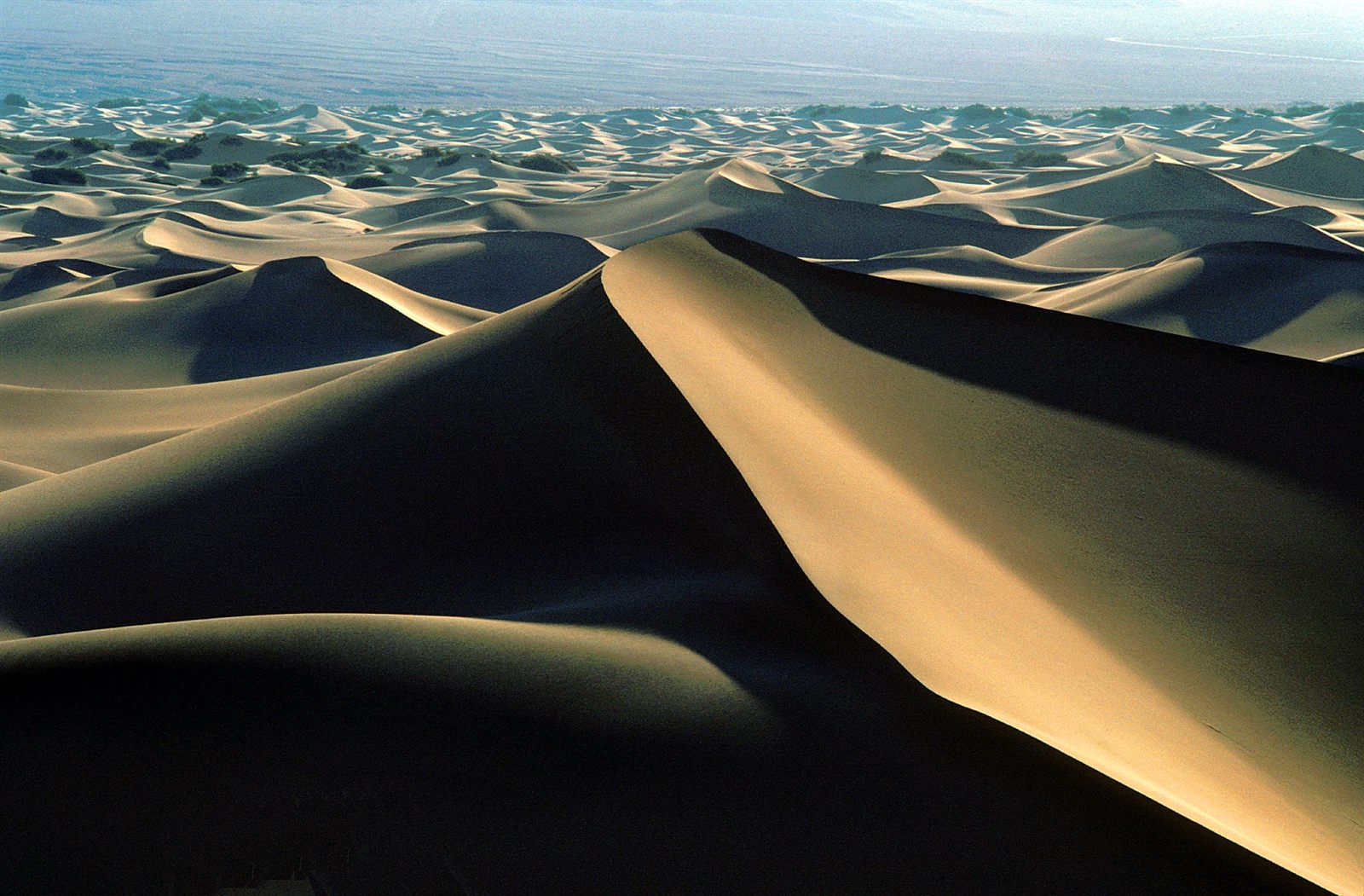
Wind-rippled sand at the Mesquite Flat Dunes, Death Valley National Park.
Sand Dune Erosion

How Sand Dunes Move and Change

Sand dunes form when wind picks up loose sand and deposits it in mounds or ridges, which then migrate and change shape as wind conditions continue to act on them.

Examples: Sossusvlei Dunes (Africa), Great Sand Dunes (North America)

Formation timescale: Rapid (hours to years)

Read the full article →
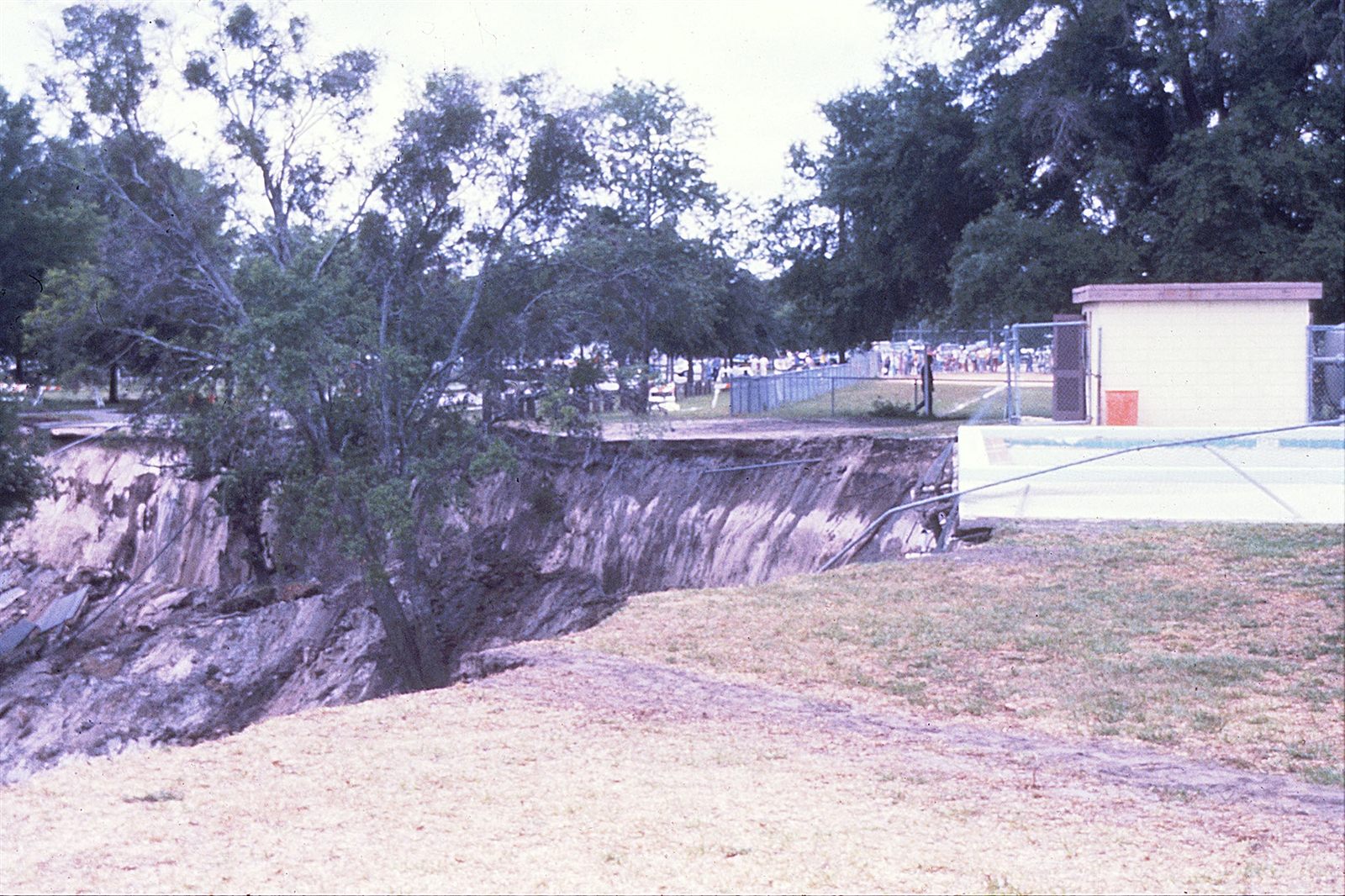
The aftermath of the 1981 Winter Park, Florida sinkhole that collapsed part of a city block.
Sinkhole Chemical Weathering

How Sinkholes Form

A sinkhole forms when an underground void, usually created by the slow dissolution of soluble rock, finally loses enough support that the ground above it collapses.

Examples: Great Blue Hole (North America), Sima Humboldt (South America)

Formation timescale: Rapid (hours to years)

Read the full article →
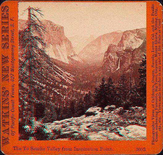
Yosemite Valley viewed from Inspiration Point.
Valley River Activity

How Valleys Are Formed

Valleys are long, low-lying corridors between higher ground, most often cut by flowing rivers and later widened or reshaped by glaciers and shifting crust.

Examples: Yosemite Valley (North America), Indus Valley (Asia)

Formation timescale: Long (hundreds of thousands of years)

Read the full article →
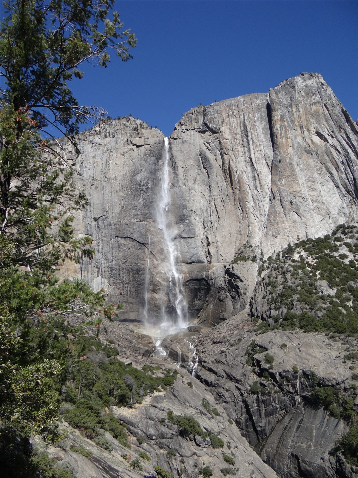
Upper Yosemite Falls viewed from the Yosemite Falls Trail.
Waterfall River Activity

How Waterfalls Form and Change

Waterfalls form wherever a river drops abruptly over a steep break in elevation, usually created by differences in rock hardness, and they continue to reshape themselves for as long as water keeps flowing over them.

Examples: Niagara Falls (North America), Victoria Falls (Africa)

Formation timescale: Medium (thousands of years)

Read the full article →
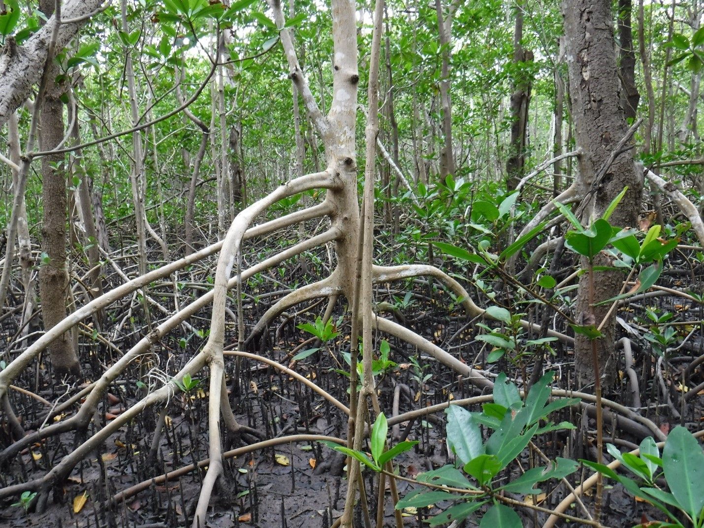
A mangrove forest wetland.
Wetland Deposition

How Wetlands Form

A wetland forms wherever land is saturated with water for long enough that it develops distinct waterlogged soils and water-adapted vegetation, whether beside a river, along a coast, or in a shallow basin.

Examples: Pantanal (South America), Everglades (North America)

Formation timescale: Medium (thousands of years)

Read the full article →
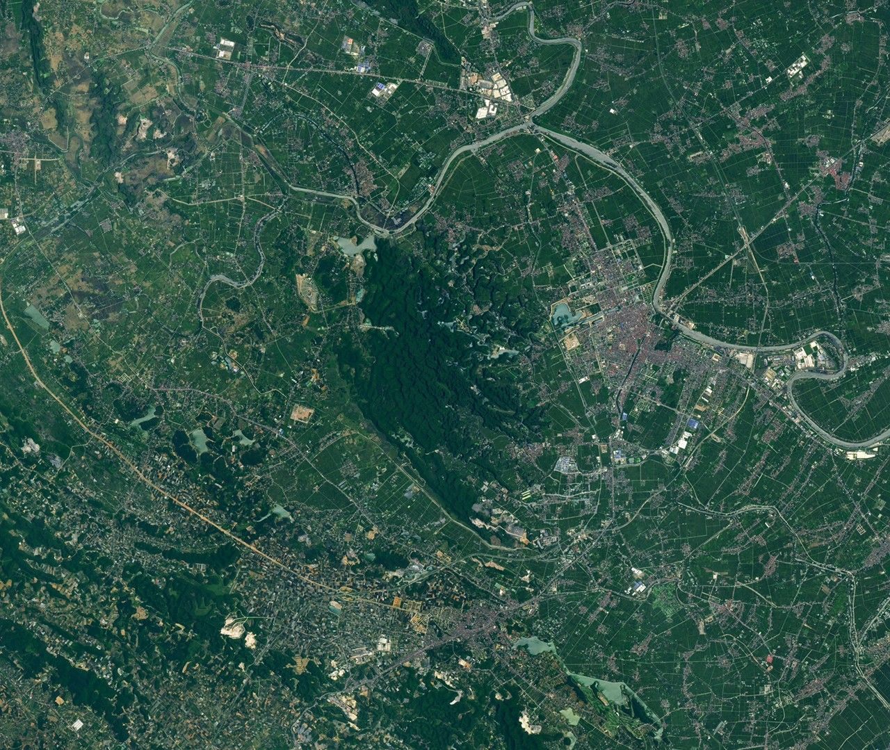
Satellite image of limestone karst towers in the Trang An landscape, Vietnam.
Karst Landscape Chemical Weathering

Karst Landscapes and Limestone Erosion

Karst landscapes form when slightly acidic rainwater slowly dissolves soluble rock such as limestone, producing caves, sinkholes, disappearing streams, and sometimes dramatic rock towers.

Examples: Guilin Karst (China), Kras Plateau (Slovenia)

Formation timescale: Very Long (millions of years)

Read the full article →
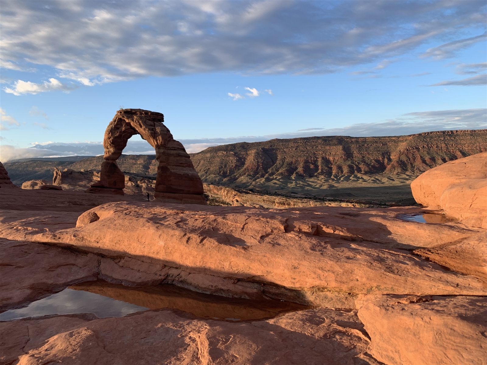
Delicate Arch in Arches National Park, Utah, after rainfall.
Natural Arch Erosion

Natural Arches and the Power of Erosion

Natural arches form when erosion and weathering hollow out a weak section of rock inside a narrow fin or headland, leaving a freestanding span that will eventually collapse under its own weight.

Examples: Delicate Arch (Utah, North America), Landscape Arch (Utah, North America)

Formation timescale: Long (hundreds of thousands of years)

Read the full article →
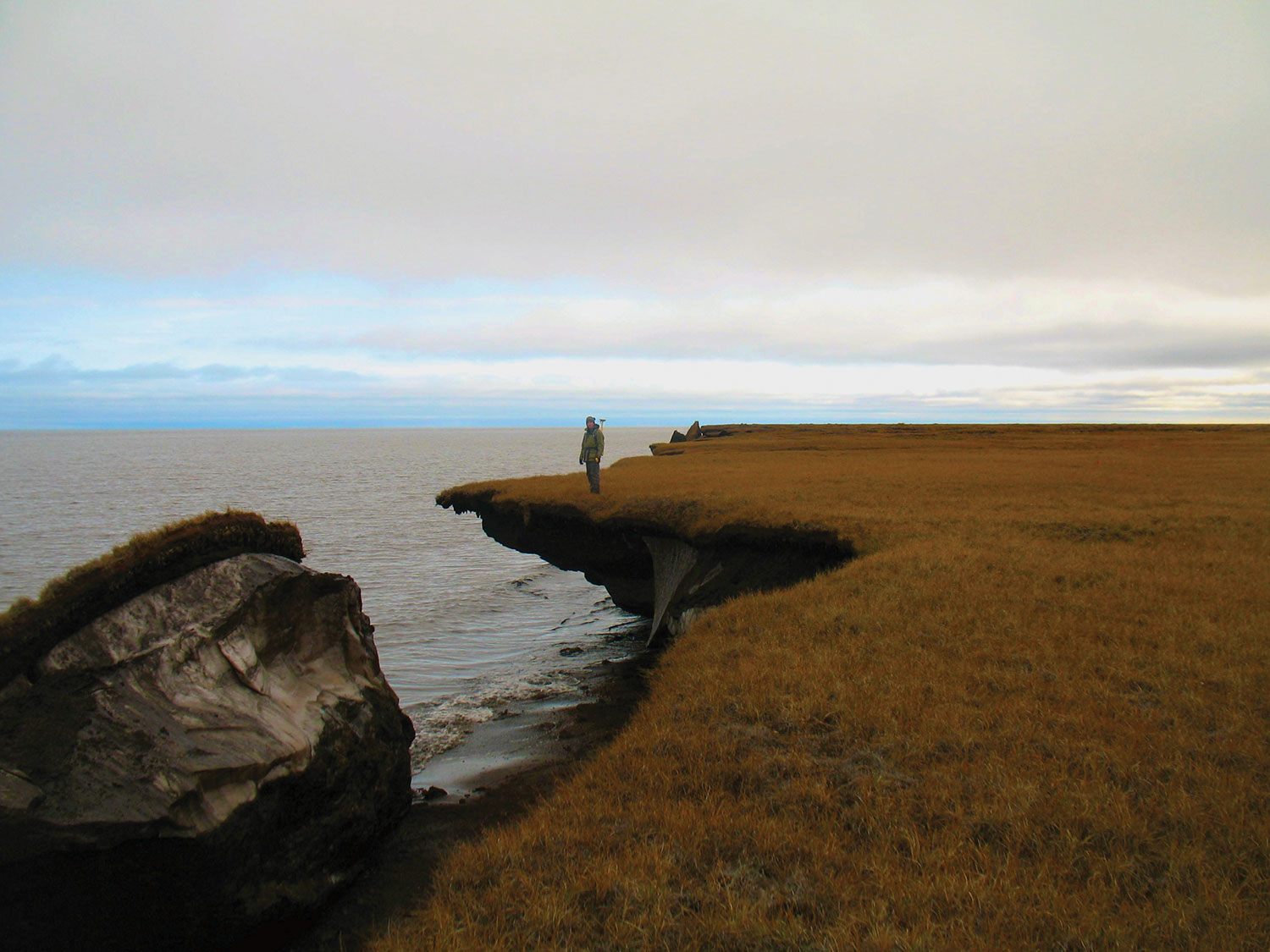
Eroding ice-rich permafrost along Alaska's Arctic coast.
Permafrost Landscape Glacial Activity

Permafrost Landscapes and Seasonal Change

Permafrost is ground that stays frozen for at least two consecutive years, and the seasonal thawing and refreezing of the thin active layer above it shapes a distinctive set of cold-region landscapes.

Examples: Siberian Permafrost (Asia/Europe), Alaskan North Slope (North America)

Formation timescale: Variable / Site-dependent

Read the full article →
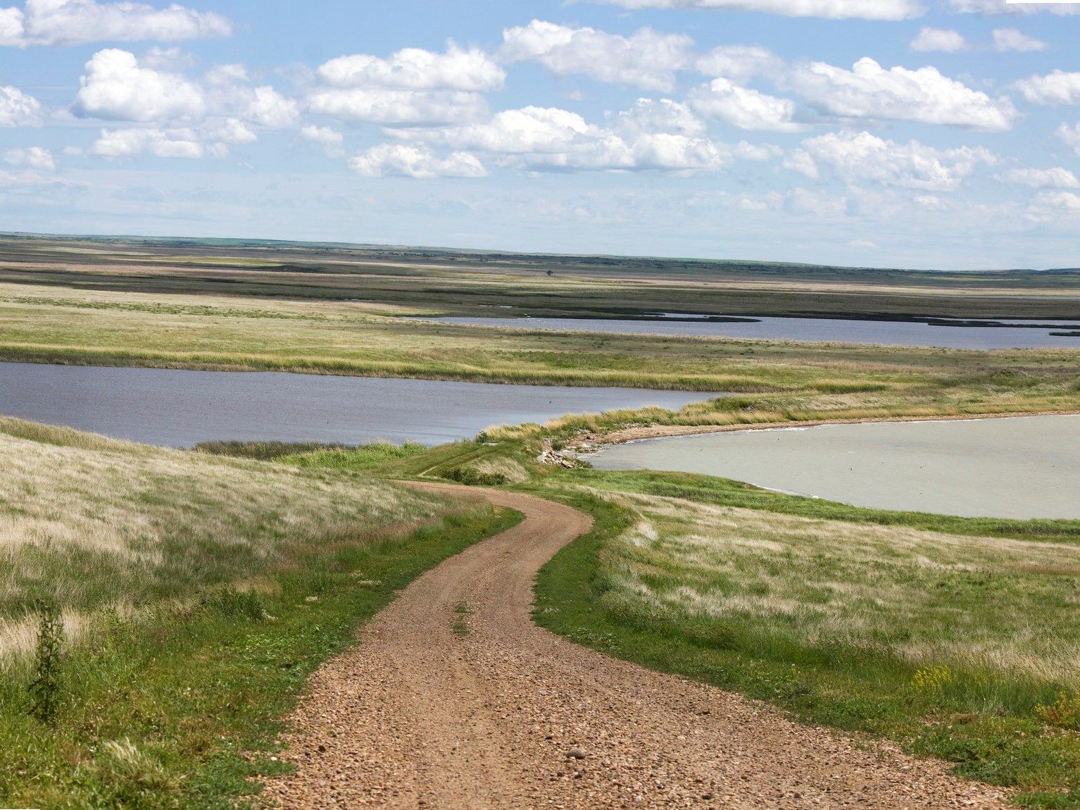
A dirt road winding through ponds and prairie grassland of the Northern Great Plains.
Plain Deposition

Plains and the Processes That Create Them

Plains are large areas of relatively flat, low-lying land, built up by long-term sediment deposition, worn down from older uplands, or formed from layered lava flows.

Examples: Great Plains (North America), North European Plain (Europe)

Formation timescale: Long (hundreds of thousands of years)

Read the full article →
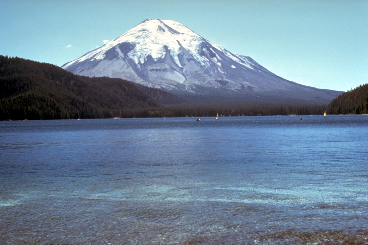
Mount St. Helens and Spirit Lake before the 1980 eruption, showing the volcano's symmetrical cone.
Volcano Volcanic Activity

The Main Types of Volcanoes

Volcanoes take on several distinct shapes depending on how fluid their magma is and how violently it erupts, from broad shield volcanoes to steep stratovolcanoes, small cinder cones, and collapsed calderas.

Examples: Mauna Loa (Hawaii, North America), Mount Fuji (Asia)

Formation timescale: Variable / Site-dependent

Read the full article →
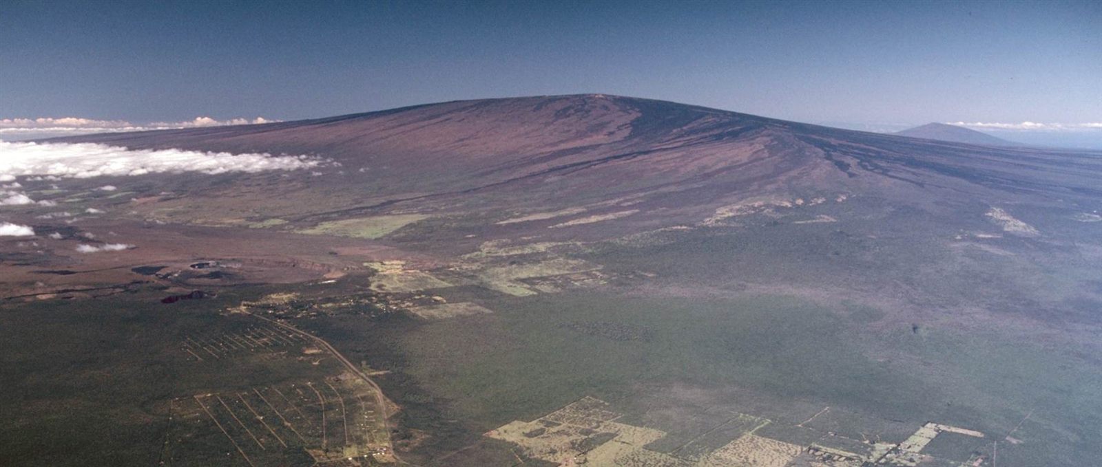
Aerial view of Mauna Loa volcano rising above Kilauea's summit caldera, Hawaii.
Island Volcanic Activity

Volcanic Islands vs Continental Islands

Islands form in two fundamentally different ways: volcanic islands are built from erupted material above hot spots or subduction zones, while continental islands are simply fragments of continental crust left isolated by rifting or rising sea levels.

Examples: Hawaii (Oceania), Iceland (Europe)

Formation timescale: Very Long (millions of years)

Read the full article →
The Great Unconformity at Colorado National Monument, where ancient granite meets much younger rock.
Landscape Concept Tectonic Activity

Why Some Natural Landscapes Take Millions of Years to Form

Natural landscapes form at wildly different speeds because rock hardness, the strength of the forces acting on it, and how continuously those forces act all combine differently from place to place, ranging from a single rockfall to tens of millions of years of mountain building.

Examples: The Grand Canyon (North America), The Himalayas (Asia)

Formation timescale: Very Long (millions of years)

Read the full article →