Definition
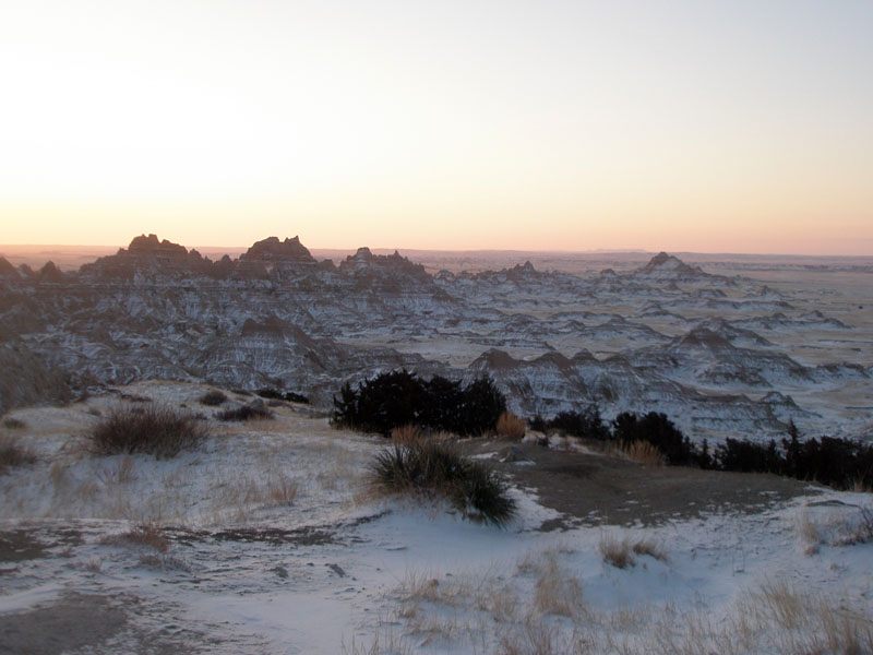
Badlands are a type of rugged, heavily eroded terrain characterized by steep, sparsely vegetated slopes, narrow ridges, and intricate networks of gullies cut into soft sedimentary rock. The name reflects how difficult this terrain historically was to cross or farm, not any particular danger beyond the practical challenges of its maze-like relief. Badlands form where soft rock, scarce vegetation, and intense but infrequent rainfall combine to produce some of the fastest erosion rates found in any natural landscape.
How It Forms
Badlands develop primarily through rapid erosion of weak sedimentary rock, often assisted by chemical weathering that breaks the rock down before water can wash it away. Unlike the slow, steady erosion that shapes many landscapes over millions of years, badlands can develop dramatic new gullies and ridges within a single human lifetime.
- Soft sediment is exposed at the surface.
Badlands typically form in areas underlain by weakly cemented layers of clay, mudstone, siltstone, or volcanic ash, often deposited long ago by ancient rivers, lakes, or windblown dust. These materials erode far more easily than harder rock such as granite or well-cemented sandstone.
- Sparse vegetation leaves the surface unprotected.
Badlands usually develop in arid or semi-arid climates where vegetation is too sparse to hold soil in place with root systems. Without plant cover to slow runoff and absorb rainfall, exposed sediment is left almost entirely vulnerable to the force of falling and flowing water.
- Infrequent, intense rainfall triggers rapid erosion.
Badlands climates typically receive relatively little rain overall, but what does fall often arrives in short, intense bursts that the dry ground cannot absorb quickly. This runoff carves narrow channels called rills, which widen and deepen into gullies with each subsequent storm.
- Gullies multiply into a dense, intricate network.
Because the underlying sediment is uniformly weak, erosion does not concentrate into a single valley the way it does in harder rock. Instead, countless parallel and branching gullies form side by side, isolating narrow ridges and spires between them and producing the maze-like relief that defines badlands terrain.
Formation Timescale
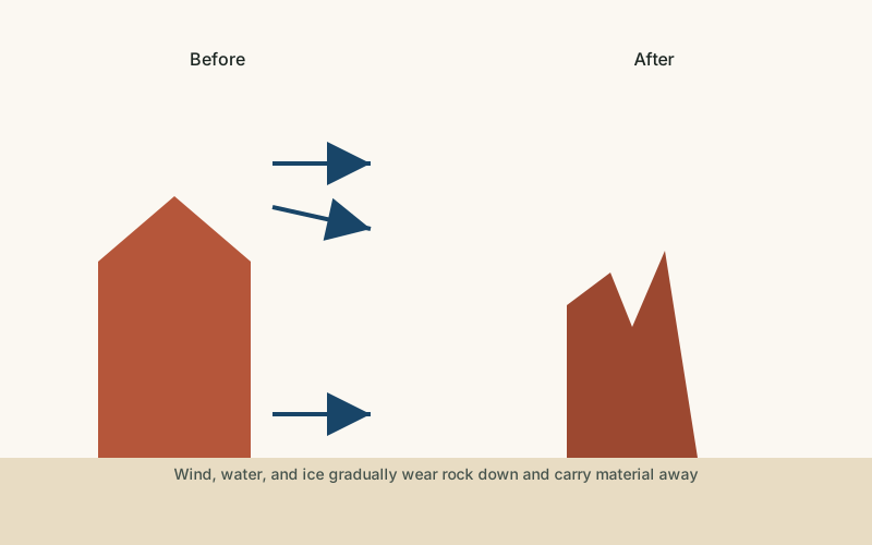
Badlands are notable for forming on a short timescale relative to most landforms described on this site — often developing substantial new ridges and gullies within decades, and visibly changing within just a few years after major storms. Researchers who monitor badlands erosion describe rates that vary enormously by site and by individual storm event, making it difficult to state a single average rate with confidence; some studies have measured localized surface lowering of several centimeters in a single year, far faster than erosion rates typical of harder rock terrain.
Main Characteristics
- Dense gully networks: closely spaced channels that branch repeatedly, often leaving little flat ground between them.
- Sparse vegetation: the steep, erodible slopes and the climates where badlands form generally support very little plant cover.
- Rapid local erosion rates: badlands are among the fastest-eroding landscapes on Earth, with measurable change possible within a single year.
- Banded or colorful rock layers: many badlands expose distinct layers of sediment in different colors, recording different periods of deposition.
- Minimal soil development: erosion typically outpaces the slow process of soil formation, leaving bare rock and sediment exposed at the surface.
Materials and Structures Involved
Badlands form almost exclusively in soft sedimentary rock, especially clay-rich mudstone and siltstone, along with volcanic ash deposits in some regions. These materials were originally laid down as fine sediment in ancient floodplains, lake beds, or windblown ash falls, then only weakly cemented together afterward, leaving them with little resistance to erosion. The same softness that makes badlands erode so quickly also makes them valuable to paleontologists, since fast-eroding slopes continually expose new fossil material that would otherwise remain buried deep underground.
Climates and Environments
Badlands are strongly associated with arid and semi-arid climates, where rainfall is too limited to support dense vegetation but still arrives in occasional intense storms capable of driving rapid erosion. This combination — sparse plant cover plus episodic heavy runoff — is more important to badlands formation than any specific temperature range, which is why badlands appear in the cold semi-arid plains of North America and in considerably different climate settings across parts of Asia, wherever soft sediment and sparse vegetation coincide.
Real Examples
Badlands National Park, in South Dakota in the United States, is one of the best-known badlands landscapes in the world and has yielded extensive fossil deposits from ancient grassland ecosystems. The Drumheller Badlands, in Alberta, Canada, are famous for exposing dinosaur fossils within their rapidly eroding slopes. Badlands terrain also appears across parts of the Loess Plateau region of China, where wind-deposited sediment has been carved into similarly intricate gully networks by intense seasonal rainfall.
How It Continues to Change
Badlands are among the most actively changing landscapes featured on this site. Each significant rainstorm can carve new gullies, undercut ridges, and trigger small landslides, meaning the terrain visible today may look noticeably different within a decade. This rapid pace of change is part of what makes badlands valuable for scientific study: erosion that would take far longer to expose comparable rock layers elsewhere happens quickly enough here to be observed within a single research career.
Some researchers return to the same badlands monitoring sites year after year specifically to measure how much a given slope or gully has changed, building up a long-term record of erosion rates that would be far harder to obtain in slower-eroding terrain. Park managers at well-visited badlands sites also have to account for this ongoing change when maintaining trails and viewpoints, since paths that were stable when built can be undercut by erosion within a relatively short time.
How It Differs From Similar Formations
Badlands are sometimes confused with canyons, but a canyon is typically a single, well-defined channel cut by a major river over a very long period, while badlands consist of many smaller, densely packed gullies cut rapidly into soft sediment by intermittent runoff rather than a continuous river. Badlands are also distinct from deserts in general; while badlands usually occur within arid or semi-arid regions, not all deserts contain badlands, since badlands require the specific combination of soft, erodible sediment that many desert landscapes, built instead on harder rock or sand, do not have.
Common Misconceptions
Misconception: Badlands got their name because they are dangerous.
Reality: The name reflects how difficult the terrain was for travelers and farmers to cross, not any inherent hazard beyond the practical difficulty of navigating steep gullies and unstable slopes.
Misconception: Badlands form over the same long timescales as mountains or canyons.
Reality: Badlands are among the fastest-changing landscapes on Earth, with measurable erosion sometimes occurring within a single year, because they form in uniquely soft, poorly cemented sediment.
Misconception: Badlands are lifeless, barren places with no ecological value.
Reality: While vegetation is sparse, badlands often support specialized plant and animal life adapted to the terrain, and their continual erosion makes them scientifically valuable for exposing fossils and sediment records.
Key Terms
- Erosion — The wearing away and removal of rock, soil, or sediment by natural forces such as water, wind, or ice.
- Weathering — The breakdown of rock in place, through physical, chemical, or biological processes, without the material being transported away.
- Chemical Weathering — The breakdown of rock through chemical reactions, such as the dissolving of limestone by slightly acidic water.
- Sediment — Solid material — fragments of rock, mineral grains, or organic matter — that is transported and deposited by water, wind, or ice.
- Sedimentary Rock — Rock formed from the compaction and cementation of accumulated sediment over time.
- Escarpment — A steep slope or cliff that marks a sharp change in elevation, often separating two relatively flat areas.