Definition
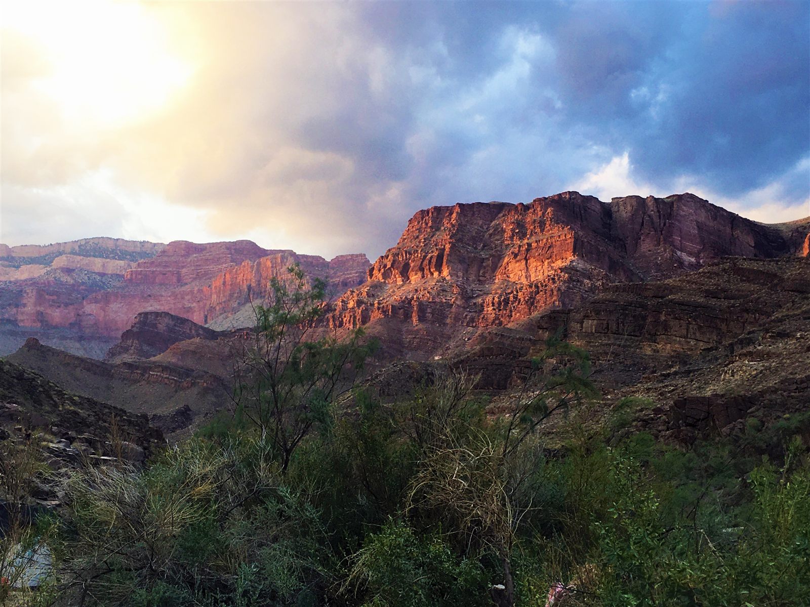
A canyon is a deep, narrow valley with steep, often near-vertical walls, cut into the land by the long-term action of flowing water. Canyons are distinguished from ordinary river valleys mainly by their depth relative to their width and by the steepness of their sides, both of which depend on how resistant the local rock is and how much the land has been uplifted while the river cuts into it. The word is sometimes used loosely for any deep gorge, but most true canyons share the same basic recipe: a river with enough energy to cut downward, combined with rock that is being raised faster than it can simply wash away sideways.
How It Forms
Canyons form where erosion and uplift happen at the same time, over very long periods. The exact sequence varies by location, but it generally follows a consistent pattern.
- A river establishes its course.
A river begins flowing across a landscape, often along a path set by existing slopes, fault lines, or softer rock. At this stage the channel may look much like any ordinary river valley.
- The land is slowly uplifted.
Tectonic forces raise the surrounding region, sometimes over tens of millions of years. Because the river's outlet (its base level) doesn't rise as fast as the land around it, the river is forced to cut downward to maintain its course.
- The river cuts down faster than the walls widen.
As long as uplift continues and the rock is resistant enough to hold a steep slope, the river deepens its channel faster than weathering can widen it. This is what keeps a canyon narrow and steep instead of spreading into a broad valley.
- Exposed rock layers record the process.
As the river cuts deeper, it exposes progressively older rock layers in the canyon walls, often creating a visible, color-banded record of hundreds of millions of years of geological history.
- Side canyons and tributaries widen the system.
Smaller tributary streams cut their own side canyons into the main gorge, and rockfall, flash floods, and frost gradually widen the upper walls even as the main channel continues to deepen.
Formation Timescale
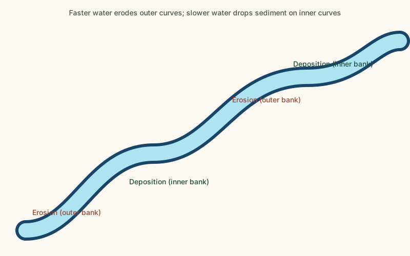
Canyon cutting is an extremely slow process by human standards, typically unfolding over millions to tens of millions of years, and the rate varies enormously by location, rock type, and climate. The deepest, most dramatic canyons generally required both substantial uplift and a long, relatively stable period during which a river could keep cutting without being interrupted by major climate or sea-level changes. Scientists continue to debate the precise timeline for specific canyons, including the Grand Canyon, where different rock layers and segments appear to have been cut during different periods rather than all at once.
Main Characteristics
- Depth-to-width ratio: canyons are proportionally much deeper relative to their width than ordinary river valleys.
- Steep or vertical walls: resistant rock layers can hold near-vertical cliff faces for long periods without collapsing.
- Exposed rock stratigraphy: canyon walls often reveal distinct, visibly layered bands of rock representing different geological time periods.
- A single dominant channel: most canyons are carved by one primary river, with smaller tributary canyons feeding into it.
- Ongoing narrow floor erosion: active canyons continue to be cut by the river at their base even as their upper walls are shaped by weathering.
Materials and Structures Involved
The rock exposed in a canyon strongly shapes its form. Sedimentary rock such as sandstone, shale, and limestone — common in many of the world's best-known canyons — tends to erode unevenly, with harder layers forming vertical cliffs and softer layers eroding into gentler slopes or ledges, producing the famous stepped profile seen in canyons like the Grand Canyon. In narrow desert "slot canyons," a single resistant rock layer, such as sandstone, is cut by flash floods into tall, extremely narrow passages only a few meters wide but tens of meters deep. In other regions, canyons are cut into harder metamorphic or igneous rock, producing narrower, more rugged gorges that erode more slowly overall.
Climates and Environments
Canyons occur most dramatically in arid and semi-arid climates, where sparse vegetation and infrequent but intense rainfall allow exposed rock to be cut and left visible rather than quickly covered in soil and plant growth. In wetter, temperate climates, rivers can cut canyons too, but the surrounding walls are more often softened by vegetation and weathering rather than left as stark exposed rock. Flash flooding plays an outsized role in desert canyon systems, where a single intense storm can move more sediment and cut more rock in a few hours than years of ordinary flow.
Real Examples
The Grand Canyon in North America, cut by the Colorado River, is one of the most studied canyons on Earth and exposes nearly two billion years of rock history in its walls. The Fish River Canyon in Namibia is one of the largest canyons in Africa, formed by a combination of river erosion and the collapse of the valley floor along fracture lines in the bedrock. The Yarlung Tsangpo Grand Canyon in Tibet is among the deepest canyons in the world, where a river cuts through the eastern Himalayas as the mountains themselves continue to rise. Antelope Canyon in the American Southwest is a well-known example of a narrow slot canyon, carved by flash floods moving through soft sandstone.
How It Continues to Change
Most major canyons are still actively changing today, even if the change is imperceptible on a human timescale. Rivers continue to cut at the canyon floor, rockfalls and landslides periodically reshape the walls, and flash floods in arid canyon systems can alter the channel significantly within hours. Human activity has also measurably changed canyon rivers: dams built along rivers like the Colorado have altered sediment flow and erosion patterns downstream, in some cases slowing the natural processes that originally carved the canyon.
How It Differs From Similar Formations
Canyons are often confused with ordinary river valleys, but a valley typically has a broader, gentler profile, while a canyon is distinguished by unusually steep walls relative to its depth, usually because uplift has outpaced widening. Canyons are also related to, but distinct from, badlands, which form through rapid erosion of soft rock into a dense network of gullies and ridges rather than a single dominant channel. A plateau is often the elevated landform that a canyon is cut into — the plateau is the raised platform, while the canyon is the incision carved through it.
Common Misconceptions
Misconception: A canyon was carved all at once by a single catastrophic flood.
Reality: With rare localized exceptions, most large canyons form through the gradual, repeated action of ordinary river flow and occasional floods over millions of years, not a single event.
Misconception: Canyons only form in deserts.
Reality: While arid climates produce the most visually dramatic and well-preserved canyons, river canyons also form in temperate and even tropical regions wherever uplift and erosion combine.
Misconception: The river that carved a canyon is necessarily small compared to the canyon itself.
Reality: The relationship between river size and canyon size depends on the timescale involved; even a modest river can carve an enormous canyon given millions of years and sufficient uplift.
Key Terms
- Erosion — The wearing away and removal of rock, soil, or sediment by natural forces such as water, wind, or ice.
- Headward Erosion — The gradual extension of a valley, gully, or stream channel upslope, toward its source, as erosion cuts further back.
- V-Shaped Valley — A narrow valley with sloped sides that meet at a point, typically carved by a river cutting downward.
- Sedimentary Rock — Rock formed from the compaction and cementation of accumulated sediment over time.
- Tributary — A smaller stream or river that flows into a larger river rather than directly into a sea or lake.
- Escarpment — A steep slope or cliff that marks a sharp change in elevation, often separating two relatively flat areas.