Definition
A valley is an elongated area of lower ground stretched between higher terrain on either side, such as hills, ridges, or mountain slopes. Valleys exist at every scale, from a small streamside gully only a few meters across to vast lowlands spanning hundreds of kilometers. Most valleys are cut by running water over long periods of time, but ice and the slow movement of the Earth's crust can also create or dramatically reshape them, which is why valleys around the world vary so widely in shape, width, and steepness.
How It Forms
The great majority of the world's valleys begin as river valleys, shaped gradually by water moving downhill under gravity. Many are later modified by glaciers, and some owe their basic shape to the pulling apart or shifting of the crust itself rather than to erosion. These mechanisms often overlap within a single valley's history.
- Water finds a path downhill.
Rainfall and snowmelt collect and flow toward the lowest available route, often following existing cracks, fractures, or softer rock within the bedrock. Over time this flow becomes organized into a channel, and nearby smaller channels, or tributaries, join it to form a connected drainage basin.
- The river cuts downward and the valley narrows into a V.
Where a river still has a steep gradient, it erodes its bed faster than its banks, cutting a narrow, steep-sided channel. This produces the classic V-shaped valley profile common in young, actively eroding mountain streams, with headward erosion gradually extending the valley upslope over time.
- Glaciers can widen an existing valley into a U shape.
In cold or high-elevation regions, glaciers often advance down a valley a river has already begun to carve. Unlike water, moving ice erodes the valley walls as well as its floor, straightening tight bends and broadening the cross-section into the distinctive flat-bottomed, steep-walled U shape left behind once the ice retreats.
- Tectonic movement can lower or tilt the valley floor.
Where the crust itself stretches, faults, or shifts, a valley floor can drop relative to the surrounding land independently of erosion, or an uplifting landscape can steepen a valley's profile and accelerate the river cutting through it. This interplay between tectonic movement and erosion shapes many of the world's largest valley systems.
- Slope processes continue to widen the valley.
Long after the main channel is established, rockfalls, landslides, and the gradual creep of loosened material down steep walls continue to wear back and widen a valley, feeding debris onto the valley floor and slowly softening its profile.
Formation Timescale
Valley formation generally unfolds over thousands to millions of years, though the exact pace varies enormously depending on rock type, climate, water volume, and whether glaciers or tectonic movement are involved. A valley cut through soft sediment by a fast-flowing river can deepen noticeably within a human lifetime, while a valley carved through resistant bedrock, or one whose shape largely reflects an ancient episode of glaciation, may have taken far longer to reach its current form and could remain largely unchanged for a very long time afterward. Because so many processes can act on the same valley at different rates, there is no single figure that applies to all valleys.
Main Characteristics
- Cross-sectional shape: river-cut valleys tend toward a narrow V shape, while glacially modified valleys are broader with a flatter floor and a U shape.
- Longitudinal profile: most valleys are steeper near their source and gradually flatten toward their outlet.
- Tributary pattern: smaller valleys typically join a main valley at an angle that reflects the local slope and rock structure.
- Hanging valleys: in glaciated terrain, smaller tributary valleys can be left stranded high above a deeper main valley once ice retreats.
- Terraces: old, abandoned valley floors can remain as stepped terraces above the current channel, marking earlier stages of downcutting.
- Asymmetry: valley walls often erode unevenly where rock resistance, sun exposure, or prevailing weather differs from one side to the other.
Materials and Structures Involved
What a valley is cut into strongly influences its shape. Valleys carved through resistant rock such as granite or well-cemented sandstone tend to retain steep walls and narrow floors, while those cut through softer shale, clay, or unconsolidated sediment widen and flatten more readily. Many valley floors are blanketed in alluvium — sand, gravel, and silt deposited by the river itself — while glacially carved valleys often contain glacial till and moraine left behind as the ice melted. These deposits frequently mask the underlying bedrock and record the valley's more recent history even where its overall shape was set much earlier.
Climates and Environments
Valleys occur in essentially every climate on Earth, which is part of why the processes shaping them are considered variable rather than tied to one setting. In humid, temperate regions, valleys are often densely vegetated and shaped primarily by steady river erosion. In arid regions, valleys may stay dry for most of the year and be shaped largely by infrequent, intense flash floods rather than constant flow. In polar and high-alpine regions, present or past glaciation dominates, producing the broad, steep-walled valleys typical of mountain ranges that have experienced repeated ice ages.
Real Examples
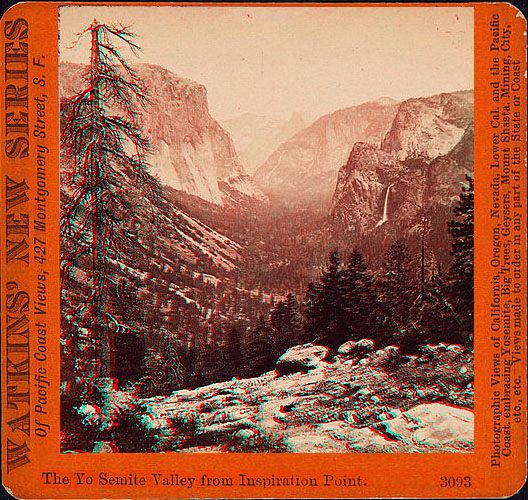
Yosemite Valley in North America began as a river valley and was later dramatically widened and steepened by glaciers, leaving the sheer granite walls visitors see today. The Indus Valley in Asia has been shaped over a very long span by the Indus River depositing fertile sediment across a broad lowland. The Rhine Valley in Europe follows a depression influenced by tectonic movement in the crust, later widened by the river that now flows through it. The Great Rift Valley in Africa shows how crustal stretching alone can create valley-like topography on a continental scale, distinct from purely erosional valleys.
How It Continues to Change
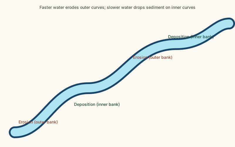
Valleys continue to change as long as the forces that shaped them remain active. Rivers keep eroding their beds and banks, shifting course across their floodplains and occasionally cutting new channels during major floods. Where glaciers still occupy a valley, their retreat or advance continues to reshape its floor and walls. Human activity has also become a significant factor in many valleys, as dams alter sediment transport downstream, and development on valley floors changes how water moves through the landscape during floods.
How It Differs From Similar Formations
Valleys are often confused with canyons, but a canyon is typically a narrower, steeper-walled type of valley usually found in arid regions where resistant rock layers allow a river to cut a deep, confined channel without the walls collapsing or widening as quickly. Valleys are also related to, but distinct from, rift valleys, where the defining process is the crust pulling apart along faults rather than water or ice wearing the land down; a rift valley can later be further shaped by rivers, but its basic depression exists independently of erosion.
Common Misconceptions
Misconception: Every valley was carved by a river.
Reality: While rivers shape the majority of the world's valleys, many were significantly widened by glaciers, and some large valleys owe their basic shape to the crust stretching or faulting rather than to water erosion.
Misconception: A valley's V or U shape always reveals exactly how it formed.
Reality: Many valleys show a mixed history, such as a glacially widened U-shaped main valley with a narrower, more recent V-shaped channel cut into its floor by the river that now occupies it.
Misconception: Valleys only change over geological time spans far beyond human observation.
Reality: Valley floors can shift measurably within a single human lifetime through flooding, channel migration, and glacial retreat, even while the valley's overall walls remain largely fixed.
Key Terms
- V-Shaped Valley — A narrow valley with sloped sides that meet at a point, typically carved by a river cutting downward.
- U-Shaped Valley — A valley with steep, rounded sides and a flat floor, carved by the broad erosive action of a glacier.
- Erosion — The wearing away and removal of rock, soil, or sediment by natural forces such as water, wind, or ice.
- Glacier — A large, slow-moving mass of ice formed from accumulated snow that persists and flows under its own weight.
- Tributary — A smaller stream or river that flows into a larger river rather than directly into a sea or lake.
- Drainage Basin — The area of land where all surface water, from rainfall to streams, drains to a common river or outlet.
- Bedrock — The solid rock that lies beneath soil, sediment, and other loose surface material.
- Tectonic Plate — One of the large, rigid sections of Earth's lithosphere that move slowly over the mantle below.