Definition
A plateau is a broad area of relatively flat or gently rolling land that sits significantly higher in elevation than the surrounding terrain, typically bordered by at least one steep edge or escarpment. Unlike a mountain, which rises to a distinct peak, a plateau retains a comparatively level top across a wide area, as if a large section of land had been lifted more or less intact. Plateaus can be enormous, covering areas as large as entire countries, and they occur on every continent through several different formation mechanisms.
How It Forms
Plateaus form through a few distinct mechanisms, though uplift and volcanic layering are the two most significant worldwide.
- Tectonic forces compress and thicken crust.
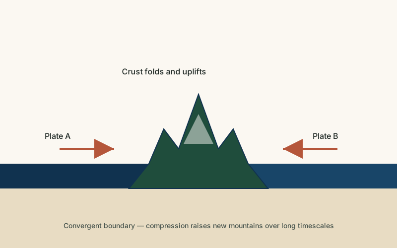
Where tectonic plates collide or push against each other, the crust in the surrounding region can thicken and rise broadly, not just along the narrow zone that becomes a mountain range.
- A large area lifts relatively evenly.
Because the uplift affects a wide area of generally similar, often already-flat-lying rock layers, the land rises largely as an intact unit rather than folding into sharp peaks, preserving a broad flat or gently tilted top.
- Alternatively, repeated lava flows build layers.
In volcanic plateaus, successive eruptions of fluid basaltic lava spread out over large areas and cool into flat layers, which stack on top of one another over repeated eruptions to build up a broad, elevated, flat-topped region.
- Rivers begin cutting into the elevated surface.
Once a plateau is elevated, rivers crossing it gain extra erosive energy from the added height, often cutting deep canyons into the plateau's surface over subsequent millions of years.
- Edges erode into escarpments.
The margins of a plateau, especially where it meets lower surrounding land, are often eroded into steep escarpments, while the plateau's interior remains comparatively flat and intact.
Formation Timescale
Large plateaus generally take millions of years to be raised to their present elevation and form through processes that continue to operate on similarly long timescales. The Tibetan Plateau, the largest and highest plateau on Earth, has been rising for roughly the last several tens of millions of years as the Indian and Eurasian plates continue to collide, though researchers continue to refine exactly when different parts of the plateau reached their current height. Volcanic plateaus can build up somewhat faster in geological terms, with major basalt plateaus sometimes forming the bulk of their thickness within a few million years of intense eruptive activity.
Main Characteristics
- Broad, elevated, relatively flat surface: the defining feature of a plateau, distinguishing it from a mountain's peaked profile.
- At least one steep bordering edge: plateaus are typically bounded by an escarpment or cliff marking the transition to lower terrain.
- Large horizontal extent: plateaus often cover vast areas, sometimes hundreds of thousands of square kilometers.
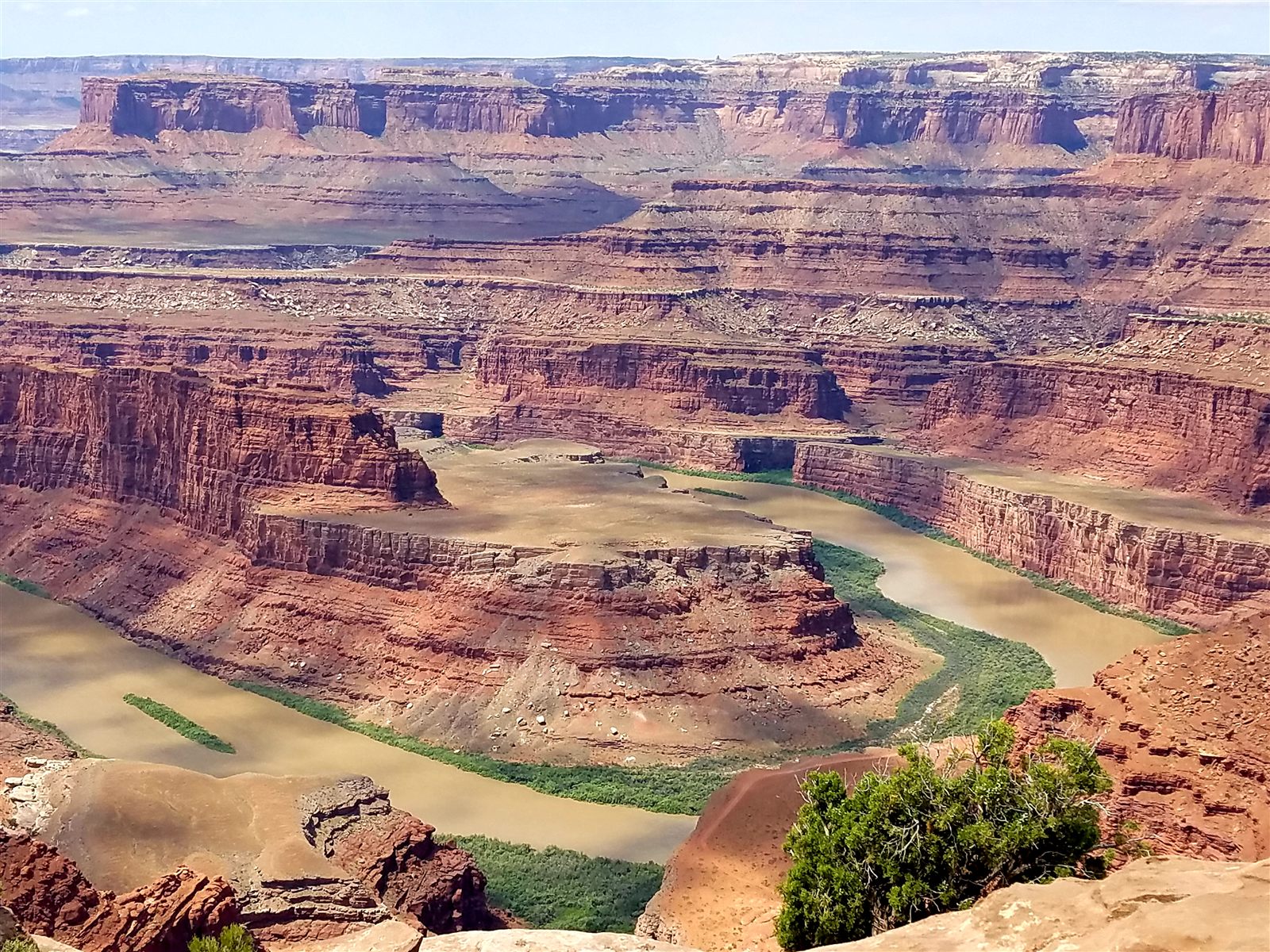
- Deeply incised river canyons: rivers crossing a plateau often carve dramatic canyons into its surface due to the added elevation.
- Relatively undisturbed internal rock layering: many plateaus preserve horizontal or gently tilted rock layers, unlike the folded rock typical of mountain ranges.
Materials and Structures Involved
The rock that makes up a plateau depends heavily on how it formed. Tectonically uplifted plateaus, like the Colorado Plateau, often consist of thick sequences of sedimentary rock — sandstone, shale, and limestone — that were deposited in ancient seas or river systems before being raised largely intact. Volcanic plateaus, such as the Deccan Plateau in India, are built from successive layers of basalt, a dark, fine-grained volcanic rock that forms from fluid lava flows capable of traveling long distances before cooling. Because basalt is relatively resistant to erosion compared to many sedimentary rocks, volcanic plateaus can sometimes retain a strikingly flat, step-like surface for a very long time after the eruptions that built them have stopped.
Climates and Environments
Because of their elevation, plateaus often have noticeably cooler and drier climates than the lowlands surrounding them, even at latitudes that would otherwise be quite warm. The Tibetan Plateau, sometimes called the "roof of the world," strongly influences regional and even global weather patterns by affecting the path of major air currents. Lower-elevation volcanic plateaus can have more varied climates depending on latitude, but their relatively flat, layered basalt surfaces often support distinct soil and drainage patterns compared to surrounding terrain.
Real Examples
The Colorado Plateau in the American Southwest is composed of thick, largely undisturbed sedimentary rock layers and contains some of the most dramatic canyon systems on Earth, including the Grand Canyon. The Tibetan Plateau in Asia is the largest and highest plateau in the world, raised by the ongoing collision between the Indian and Eurasian plates. The Deccan Plateau in India is a vast volcanic plateau built from one of the largest basalt lava outpourings in Earth's history. The Ethiopian Highlands in Africa combine volcanic plateau material with later tectonic uplift associated with the nearby East African Rift.
How It Continues to Change
Many plateaus continue to be shaped by the same forces that created them. Tectonically active plateaus, including parts of the Tibetan Plateau, continue to experience slow uplift and occasional earthquakes tied to ongoing plate movement. Meanwhile, rivers crossing plateau surfaces everywhere continue to cut deeper canyons and erode plateau edges, gradually reducing the plateau's original extent at its margins even as tectonic forces, where still active, continue to raise its interior.
In regions where uplift has slowed or stopped entirely, erosion dominates, and over long enough timescales an old plateau can be gradually reduced to a more irregular, hilly landscape as rivers cut further into its original flat surface. Comparing plateaus at different stages of this erosional history helps researchers understand roughly how such landscapes evolve once the forces that originally raised them subside.
How It Differs From Similar Formations
Plateaus are often confused with mountains, but the key distinction is shape and extent: a mountain rises to a distinct peak over a relatively small area, while a plateau preserves a broad, largely flat top across a much wider region. Plateaus are closely linked to canyons, since a plateau's elevation is often exactly what gives a river the extra erosive energy needed to carve a deep canyon into its surface. Rift valleys sometimes border or cut through plateau regions but form through crust pulling apart rather than the broad uplift or layering that builds a plateau.
Common Misconceptions
Misconception: Plateaus are just unusually large, flat-topped mountains.
Reality: Plateaus and mountains typically form through different combinations of processes; a plateau's defining trait is its broad, largely intact flat top, not simply having a flat summit.
Misconception: Plateau surfaces are untouched by erosion.
Reality: Many plateaus, especially those crossed by major rivers, are extensively eroded into canyons and valleys even while retaining an overall flat-topped profile at a broader scale.
Misconception: All plateaus formed the same way.
Reality: Some plateaus are raised by tectonic uplift of existing rock layers, while others are built up entirely from repeated volcanic lava flows — two genuinely different processes that happen to produce a similar overall shape.
Key Terms
- Isostasy — The gravitational balance between the Earth's crust and the denser mantle beneath it, which causes crust to rise or sink as weight is added or removed.
- Tectonic Plate — One of the large, rigid sections of Earth's lithosphere that move slowly over the mantle below.
- Basalt — A dark, fine-grained volcanic rock formed from rapidly cooled lava, rich in iron and magnesium.
- Escarpment — A steep slope or cliff that marks a sharp change in elevation, often separating two relatively flat areas.
- Sedimentary Rock — Rock formed from the compaction and cementation of accumulated sediment over time.
- Erosion — The wearing away and removal of rock, soil, or sediment by natural forces such as water, wind, or ice.