Definition
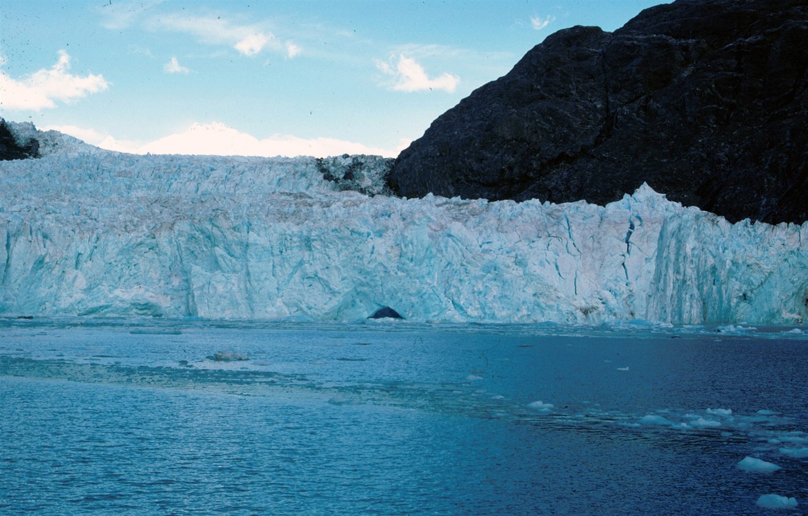
A fjord is a long, narrow, and often very deep inlet of the sea that occupies a valley originally carved by a glacier. Unlike an ordinary river valley, a fjord typically has a distinctive U-shaped cross-section, with steep, nearly vertical walls rising hundreds or even thousands of meters above the water. What makes a fjord different from a simple flooded valley is its origin: the shape of the basin was cut by moving ice, not by a river, and the sea only filled the space afterward. Fjords are found almost exclusively along mountainous coastlines at high latitudes, where glaciers once extended from the interior all the way to the sea.
How It Forms
Fjords form over an extremely long sequence of events that combines glacial carving with later changes in sea level. The process depends on a specific combination of conditions — mountainous terrain, a cold enough climate to sustain glaciers, and a coastline where ice could reach the ocean — which is why fjords are concentrated in a relatively small number of regions worldwide.
- Valley glaciers form in coastal mountains.
During cold periods, snow accumulates in mountain basins faster than it melts, compacting into glacial ice. Where coastal mountains are steep and the climate is cold enough, these glaciers grow large enough to flow downhill under their own weight, following existing river valleys toward the sea.
- Moving ice carves and deepens the valley.
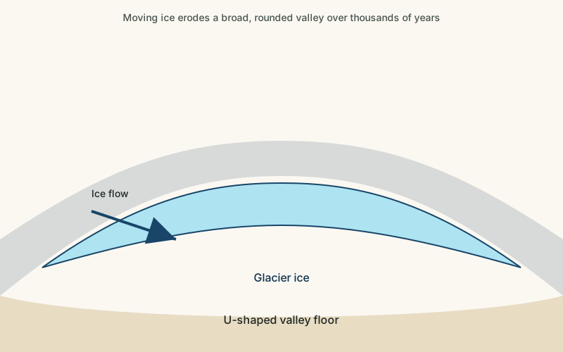
As a glacier flows, it drags embedded rock and debris along its base and sides, grinding away at the bedrock through abrasion. Glacial ice is far more effective than a river at widening and deepening a valley, straightening its course and carving the sides into steep walls while scouring the floor well below sea level — a process called overdeepening.
- The glacier retreats as the climate warms.
When the climate warms, glaciers lose more ice to melting than they gain from snowfall, and the ice front retreats back up the valley. The glacier leaves behind the deeply carved trough it created, often marked by ridges of debris called moraines, including a shallow ridge sometimes left right at the valley mouth.
- Rising seas flood the carved valley.
As glaciers melt worldwide, sea level rises, and in many formerly glaciated regions the land itself also rebounds upward after the weight of the ice is removed. Seawater floods into the deep, glacially carved valley, creating the long, steep-sided, saltwater inlet recognized today as a fjord.
Formation Timescale
The carving of a fjord happens on a very long timescale, though the exact pace is difficult to pin down and varies enormously by location. Most of the world's best-known fjords were cut primarily during the repeated glaciations of the Pleistocene Ice Age, a period spanning roughly the last 2.6 million years, with the most recent major carving occurring during the last glacial maximum around 20,000 years ago. The flooding stage, by contrast, happened comparatively quickly as ice sheets melted at the end of the last glaciation, over a span of only about 10,000 to 15,000 years. Because glacial advances and retreats overlapped repeatedly across many ice ages, scientists generally describe fjord formation as the cumulative result of multiple glacial cycles rather than a single, precisely dated episode.
Main Characteristics
- U-shaped cross-section: steep, near-vertical walls rising from a relatively flat, deep floor, in contrast to the V-shape of a river-carved valley.
- Great depth: many fjords are deeper than the open ocean just offshore, a direct result of glacial overdeepening.
- A shallow sill near the mouth: a ridge of glacial debris often creates a shallower threshold where the fjord meets the open sea.
- Hanging tributary valleys: smaller glacial valleys that fed into the main glacier often end abruptly partway up the fjord wall, sometimes producing waterfalls.
- Branching, winding channels: fjord systems frequently split into multiple arms, following the paths that tributary glaciers once carved.
Materials and Structures Involved
Fjords are cut almost entirely into hard, resistant bedrock, typically ancient crystalline rock such as granite or gneiss that can withstand the grinding force of moving ice without collapsing into a wider, gentler valley. The glacier itself leaves behind characteristic deposits: unsorted mixtures of rock and sediment known as glacial till, often piled into ridges of moraine along the valley floor and at its mouth. Once the valley is flooded, new layers of marine sediment begin settling on top of the older glacial material, gradually building up the fjord floor even as the surrounding rock walls remain largely unchanged.
Climates and Environments
Fjords form in cold, often wet climates at high latitudes or high elevations, where mountains are steep enough and close enough to the coast for glaciers to reach the sea. The surrounding mountains frequently intercept moist ocean air, producing heavy precipitation on windward slopes that historically fed the glaciers that carved the fjords. Today, these environments support distinctive marine ecosystems: fresh meltwater and river input often create a layer of less salty water floating atop denser seawater, a stratification that shapes which organisms can thrive at different depths within the fjord.
Real Examples
Sognefjord in Norway is one of the longest and deepest fjords in the world, reaching far inland between steep mountain walls. Milford Sound in New Zealand, despite its name, is a true fjord rather than a sound, carved by glaciers moving through the Southern Alps toward the Tasman Sea. Glacier Bay in Alaska offers a rare chance to see fjord formation still partly in progress, with tidewater glaciers actively calving ice into newly exposed inlets. Scoresby Sund in Greenland is among the largest fjord systems on Earth, its many branching arms tracing the paths of glaciers that once drained a vast ice sheet.
How It Continues to Change
Fjords continue to change today, though usually more slowly than during active glaciation. In regions where tidewater glaciers still reach the sea, ongoing calving continues to carve and reshape the uppermost sections of the fjord. Elsewhere, rivers and streams feeding into fjords deposit sediment that gradually fills in parts of the basin. Rising global sea levels and continued glacier retreat are altering fjord environments as well, changing the balance of fresh and salt water and, in some high-latitude fjords, exposing new rock and ice that had been covered for thousands of years.
How It Differs From Similar Formations
Fjords are often confused with ordinary valleys, but a river-carved valley typically has a V-shaped profile and was never deep enough below sea level to flood into a saltwater inlet. Fjords are also sometimes grouped with other coastal inlets shaped mainly by waves and currents, but true coastal erosion landforms are cut directly by the sea into existing rock, rather than inheriting a valley shape carved earlier by glacial ice. The distinction matters because it explains why fjords, unlike most coastal inlets, tend to be unusually deep, narrow, and steep-walled.
Common Misconceptions
Misconception: Fjords and river estuaries are the same kind of feature.
Reality: An estuary forms where a river meets the sea in a valley shaped mainly by river and tidal processes, while a fjord's basic shape was carved by glacial ice long before the sea moved in.
Misconception: Fjords only exist in Norway.
Reality: Norway has an especially large number of well-known fjords, but similar glacially carved coastal inlets occur in New Zealand, Chile, Alaska, Greenland, Canada, and Antarctica.
Misconception: Fjords are shallow near-shore features like most bays.
Reality: Many fjords are deeper than the adjacent open ocean, because glacial overdeepening can scour the valley floor far below current sea level.
Key Terms
- Glacier — A large, slow-moving mass of ice formed from accumulated snow that persists and flows under its own weight.
- U-Shaped Valley — A valley with steep, rounded sides and a flat floor, carved by the broad erosive action of a glacier.
- Moraine — A ridge of rock debris deposited directly by a glacier, usually marking its former edge or extent.
- Calving — The breaking away of chunks of ice from the edge of a glacier or ice shelf, often where it meets open water.
- Crevasse — A deep crack in a glacier's surface, formed as the ice moves and stretches over uneven terrain.
- Bedrock — The solid rock that lies beneath soil, sediment, and other loose surface material.
- Sediment — Solid material — fragments of rock, mineral grains, or organic matter — that is transported and deposited by water, wind, or ice.