Definition
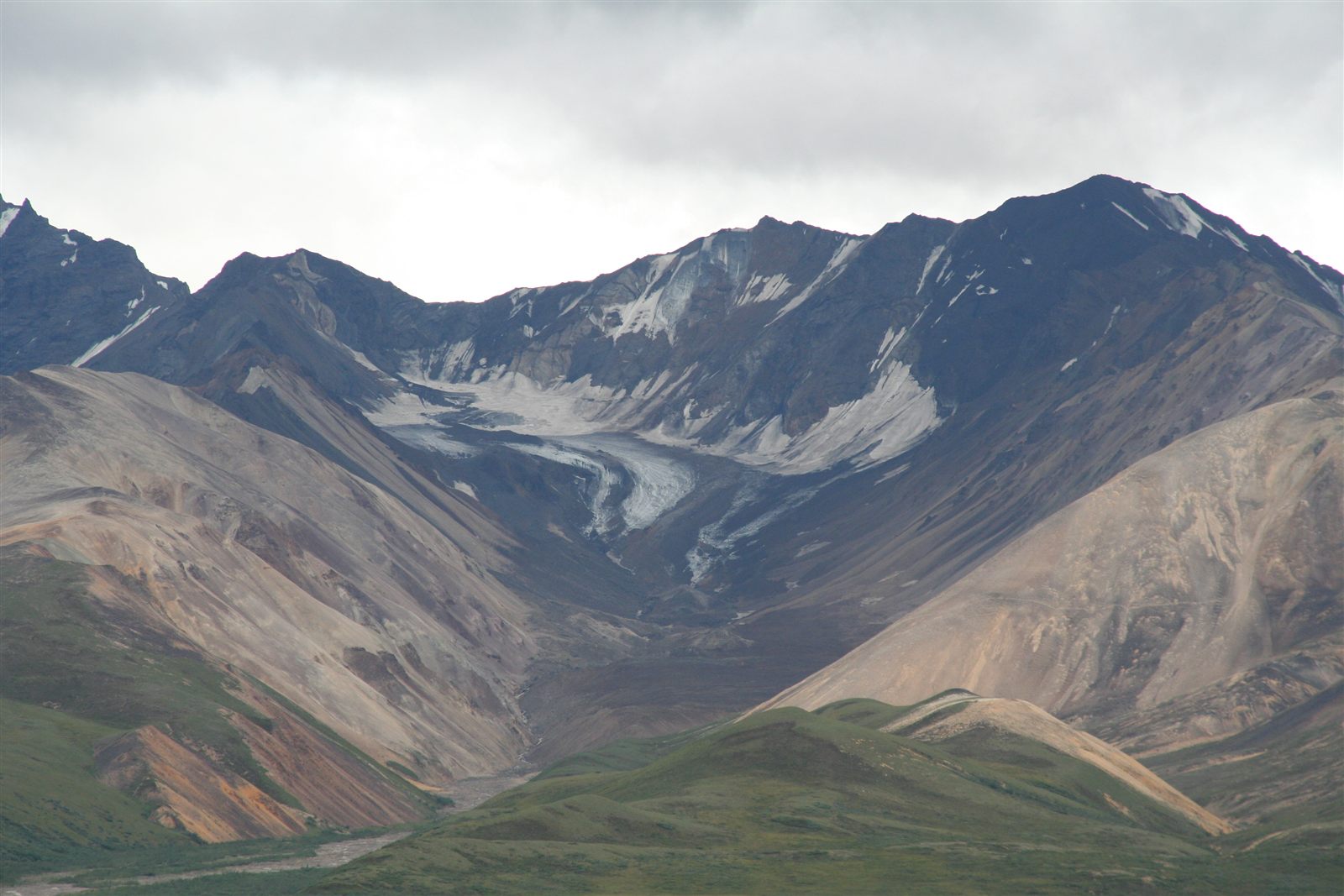
A glacier is a large, persistent body of ice that forms from accumulated snow and flows slowly under the pull of its own weight and gravity. Glaciers exist wherever snowfall consistently exceeds melting over long periods, allowing layers of snow to compact into dense ice over years. Although they move far slower than water, typically from centimeters to a few meters per day, glaciers are powerful agents of erosion and deposition, capable of reshaping entire mountain ranges and valley systems over the course of repeated ice ages.
How It Forms
A glacier's effect on the landscape unfolds through several linked mechanisms as the ice forms, moves, and eventually retreats.
- Snow accumulates and compresses into ice.
In cold, high-elevation, or high-latitude regions, snow builds up faster than it melts. Over years, the weight of new snow compresses older layers into dense glacial ice.
- Gravity sets the ice in motion.
Once it reaches sufficient thickness, the ice begins to flow slowly downhill under its own weight, deforming internally and sliding over the bedrock below.
- Rock and debris are picked up and dragged along.
As the glacier moves, it plucks rock fragments from the bedrock and carries them embedded in and beneath the ice, using them almost like sandpaper against the surrounding terrain.
- The embedded debris erodes the landscape.
This process, called abrasion, along with the physical plucking of larger rock blocks, grinds down mountainsides, widens valley floors, and carves out bowl-shaped hollows near the glacier's source.
- Retreat leaves behind deposited material.
As a glacier melts back or retreats, it drops the rock and sediment it was carrying, forming ridges called moraines and other distinctive deposits that mark its former extent.
Formation Timescale
Glacial landscapes typically take tens of thousands to hundreds of thousands of years to develop their most dramatic features, often shaped across multiple glacial periods rather than a single advance. The rate at which a glacier erodes depends heavily on its size, speed, and the hardness of the underlying rock, so comparisons between different glaciated regions can vary considerably. Many of the most iconic glacial landscapes visible today, including much of the terrain in the Alps and Scandinavia, were shaped primarily during the most recent major glacial period, which ended roughly 11,000 years ago, though older glacial episodes also left their mark in many of the same regions.
Main Characteristics
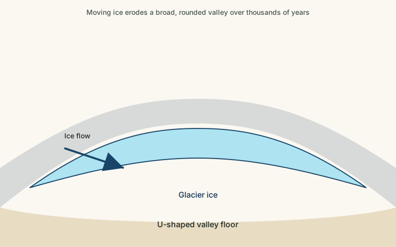
- U-shaped valleys: glaciers erode valley floors and walls broadly, producing a rounded, U-shaped cross-section quite different from a river's narrower V-shaped valley.
- Cirques and arêtes: bowl-shaped hollows (cirques) and sharp ridges (arêtes) form where glacial erosion is concentrated near mountain summits.
- Striations and polish: rock surfaces scoured by embedded debris often show fine parallel scratches and a smoothed, polished texture.
- Moraines: ridges of deposited rock and sediment mark the edges and former extent of a glacier.
- Erratic boulders: large rocks are sometimes transported far from their origin and left behind in areas of completely different local geology.
Materials and Structures Involved
Glaciers themselves are made of compacted snow that has recrystallized into dense ice, often containing trapped air bubbles and, in some cases, layers of volcanic ash or dust that record past climate events. The material a glacier erodes and deposits, broadly called glacial till, is typically an unsorted mixture of clay, sand, gravel, and boulders, distinct from the sorted layers left by flowing water because ice carries everything together regardless of size. Where meltwater does flow from a glacier, it can rework some of this material into more sorted deposits downstream.
Climates and Environments
Glaciers form and persist only where the climate is cold enough, either from high latitude, high elevation, or both, for snow accumulation to outpace melting over the long term. Polar ice sheets, such as those covering Antarctica and Greenland, represent the largest glacial environments on Earth, while alpine or mountain glaciers occur at high elevation even in otherwise temperate or tropical latitudes. Because glaciers are extremely sensitive to temperature, they are widely used as visible indicators of regional and global climate trends, and most of the world's glaciers outside of Antarctica have been retreating in recent decades.
Real Examples
The Perito Moreno Glacier in Argentine Patagonia is one of the relatively few glaciers in the region that has remained roughly stable rather than retreating in recent decades. The Jakobshavn Glacier in Greenland is one of the fastest-moving and most closely monitored outlet glaciers draining the Greenland ice sheet. The Aletsch Glacier in the Swiss Alps is the largest glacier in the Alps and has carved a dramatic U-shaped valley over repeated glacial periods. The Franz Josef Glacier in New Zealand descends unusually close to sea level for its latitude, carving through temperate rainforest terrain.
How It Continues to Change
Glaciers are among the most visibly dynamic landforms on the planet, constantly gaining mass through snowfall and losing it through melting and calving, where chunks of ice break away at the glacier's edge. Most of the world's glaciers have been losing more mass than they gain in recent decades, causing many to retreat and thin measurably within a single human lifetime. Where a glacier retreats, it often exposes raw, recently eroded terrain and deposits that begin to be reshaped by rivers, vegetation, and weathering almost immediately.
Scientists track glacier change using a combination of ground-based measurements, repeat photography, and satellite imagery, which together allow fairly precise monitoring of how much ice a given glacier has gained or lost over a specific period. This long-term record is one of the more direct, visible lines of evidence used to study regional and global climate trends, since glacier mass is closely tied to temperature and snowfall patterns over time.
How It Differs From Similar Formations
Glacially carved valleys are often compared to river-carved valleys, but the two have distinctly different shapes: glaciers erode broadly to create a rounded U-shaped cross-section, while rivers cut a narrower V-shaped channel. Fjords are a specific, closely related landform — essentially glacially carved valleys that have since been flooded by the sea. Permafrost landscapes are shaped by frozen ground rather than moving ice and involve a very different set of seasonal freeze-thaw processes, even though both occur in cold climates.
Common Misconceptions
Misconception: Glaciers are motionless blocks of ice.
Reality: Glaciers are constantly flowing, typically at rates from centimeters to a few meters per day, even though the motion is far too slow to observe directly.
Misconception: All glacial landscapes were shaped during a single "ice age."
Reality: Earth has experienced many glacial periods, and many glaciated landscapes show evidence of repeated advances and retreats over hundreds of thousands of years, not just one event.
Misconception: Glacier retreat only affects the area immediately around the ice.
Reality: Glacier melt contributes to sea-level rise and changes downstream water supplies far beyond the glacier itself, affecting regions well outside the immediate landscape.
Key Terms
- Glacier — A large, slow-moving mass of ice formed from accumulated snow that persists and flows under its own weight.
- Crevasse — A deep crack in a glacier's surface, formed as the ice moves and stretches over uneven terrain.
- Moraine — A ridge of rock debris deposited directly by a glacier, usually marking its former edge or extent.
- Cirque — A bowl-shaped hollow carved into a mountainside at the head of a glacier by rotational ice movement and erosion.
- Arête — A sharp, narrow mountain ridge formed when glaciers erode both sides of a mountain spine.
- U-Shaped Valley — A valley with steep, rounded sides and a flat floor, carved by the broad erosive action of a glacier.
- Glacial Till — Unsorted sediment — a mix of clay, sand, gravel, and boulders — deposited directly by a glacier.
- Calving — The breaking away of chunks of ice from the edge of a glacier or ice shelf, often where it meets open water.