Definition
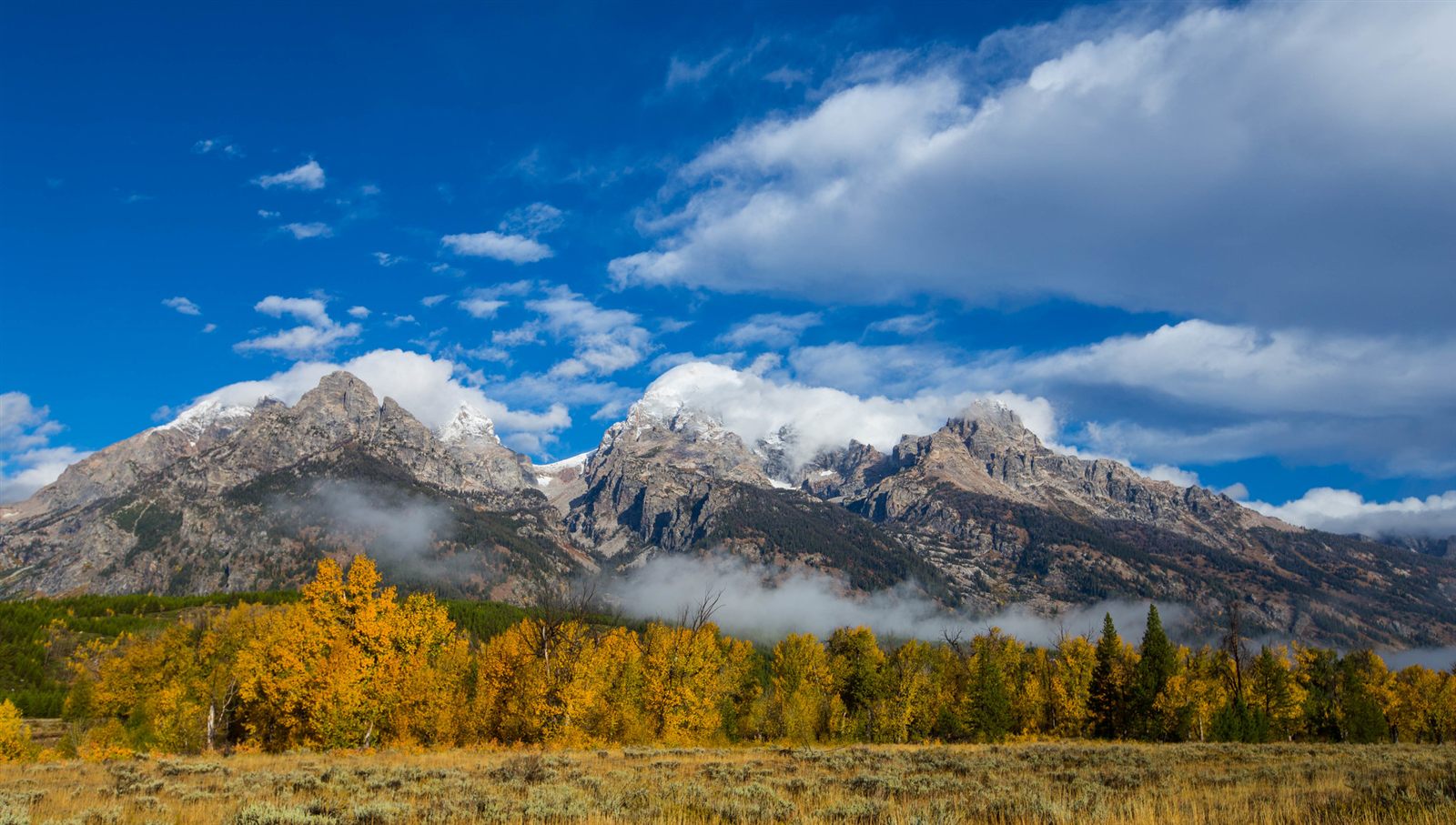
A mountain is a landform that rises sharply above the surrounding terrain, typically with steep sides and a summit well above the elevation of nearby land. There is no single worldwide threshold that separates a "mountain" from a "hill" — different countries and surveying bodies use different cutoffs — but mountains are generally understood as prominent, elevated landforms built by forces originating deep within the Earth, then reshaped at the surface. Mountains rarely form alone; they usually occur in connected chains, or ranges, that trace the boundaries where the Earth's crust has been pushed, folded, or lifted.
How It Forms
Most large mountain ranges form through orogeny, the geological term for mountain-building. Orogeny is driven primarily by the movement of tectonic plates, though volcanic activity and vertical crustal movement also build mountains in some regions. The process typically unfolds in overlapping stages rather than a strict sequence, and different ranges combine these mechanisms in different proportions.
- Plates converge.
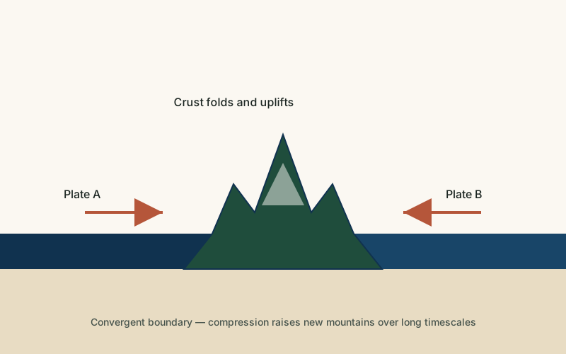
Earth's crust is broken into large tectonic plates that drift slowly over the mantle below, typically a few centimeters per year. Where two plates move toward each other at a convergent boundary, something has to give: the crust compresses, thickens, and is pushed upward.
- Crust folds, faults, or is forced under.
When two continental plates collide, neither is dense enough to sink easily beneath the other, so the crust between them crumples and folds upward — the mechanism behind the Himalayas, still rising as the Indian Plate pushes into Eurasia. Where an oceanic plate meets a continental plate, the denser oceanic plate is usually forced underneath in a process called subduction, and the resulting compression and rising magma build ranges such as the Andes.
- Rock is lifted and thickened.
Repeated compression thickens the crust over millions of years. Because thicker, lower-density continental crust floats higher on the mantle (a balance known as isostasy), this thickened crust is gradually pushed upward, raising both the mountains above and the "root" of displaced rock below them.
- Surface processes carve the final shape.
Tectonic uplift only provides the raw material. The jagged peaks, sharp ridges, and deep valleys visible in most mountain ranges are carved afterward by glaciers, rivers, frost, and wind, which continue to erode the rising rock even as tectonic forces keep pushing it up.
Formation Timescale
Mountain building is one of the slowest processes described on this site. Active ranges like the Himalayas have been rising for roughly the last 50 million years and continue to gain height today, though erosion offsets much of that uplift. Other ranges, such as the Appalachians in eastern North America, formed hundreds of millions of years ago and have been eroding for far longer than they were actively rising, which is part of why they are lower and more rounded than younger ranges. Because uplift and erosion happen simultaneously and at rates that vary by location, there is no single number that describes "how long mountains take to form" — it depends on the range, the forces involved, and how it is measured.
Main Characteristics
- Elevation relative to surroundings: mountains stand out sharply from adjacent lowlands, not just in absolute height.
- Steep slopes: the angle of a mountainside is shaped by rock strength, uplift rate, and how actively it is being eroded.
- Linear ranges: most mountains occur in chains that trace a tectonic boundary rather than as isolated peaks.
- Internal structure: many mountains expose folded, faulted, or tilted rock layers that record the compression that built them.
- A root of thickened crust: large ranges are typically underlain by crust that is thicker than the surrounding region.
Materials and Structures Involved
The rock exposed in a mountain range depends heavily on how it formed. Collision-built ranges like the Himalayas expose large amounts of folded sedimentary and metamorphic rock that was once seafloor sediment, now lifted thousands of meters above sea level. Subduction-related ranges like the Andes contain extensive igneous rock from volcanic activity associated with the subducting plate, alongside older continental basement rock. Older, heavily eroded ranges often expose deep metamorphic and igneous "basement" rock that was once buried far below the surface and has only been revealed after enormous amounts of overlying material eroded away.
Climates and Environments
Because mountains gain elevation quickly over short horizontal distances, they often contain several climate zones stacked on top of one another — temperate forest at lower elevations, alpine tundra higher up, and permanent snow and ice near the summit in sufficiently tall or high-latitude ranges. This effect, sometimes called altitudinal zonation, means a single mountain can show climate patterns that would otherwise be separated by thousands of kilometers of latitude. Mountain ranges also strongly influence regional weather, forcing air upward on one side (increasing rainfall) and creating drier conditions on the opposite, "leeward" side.
Real Examples
The Himalayas, still actively rising from the ongoing collision between the Indian and Eurasian plates, contain the highest peaks on Earth, including Mount Everest. The Andes, the longest continental mountain range in the world, were built largely by subduction along the western edge of South America and remain volcanically active in several sections. The Rocky Mountains in North America formed through a more complex combination of compression and uplift further from the plate boundary itself. The Alps in Europe resulted from the collision between the African and Eurasian plates and expose dramatically folded rock layers visible from many of their valleys.
How It Continues to Change
Mountains are never finished. Ranges at active plate boundaries, such as the Himalayas and the Andes, continue to gain elevation as tectonic forces persist, even as wind, water, ice, and gravity simultaneously wear them down. In ranges where tectonic uplift has slowed or stopped, such as the Appalachians, erosion dominates, gradually lowering and rounding peaks that were once as dramatic as any active range. Earthquakes associated with ongoing plate movement can also reshape mountain terrain abruptly, triggering landslides that alter slopes within seconds rather than millennia.
How It Differs From Similar Formations
Mountains are sometimes confused with plateaus, but a plateau is a broad, relatively flat elevated area, while a mountain has a distinct peak and steep sides rising from its base. Mountains are also related to, but distinct from, individual volcanoes: a volcano is built from erupted material and can form a mountain-like cone, but many mountains contain no volcanic material at all and were built purely by tectonic compression. Rift valleys occur at the opposite kind of plate boundary, where crust pulls apart rather than collides, sometimes producing mountain-like ridges along their edges but through a fundamentally different mechanism.
Common Misconceptions
Misconception: Mountains are permanent, unchanging features.
Reality: Every mountain range is simultaneously being built up and worn down. Which effect dominates depends on whether the range is still tectonically active.
Misconception: All mountains are volcanic.
Reality: Most of the world's largest ranges, including the Himalayas and most of the Rockies, formed primarily through tectonic compression and folding, not volcanic eruption.
Misconception: Taller mountains are always older.
Reality: The opposite is often true. Younger, still-rising ranges like the Himalayas tend to be taller and more jagged, while much older ranges like the Appalachians have had far longer to erode and are comparatively low and rounded.
Key Terms
- Tectonic Plate — One of the large, rigid sections of Earth's lithosphere that move slowly over the mantle below.
- Orogeny — The geological process of mountain building, typically driven by the collision or convergence of tectonic plates.
- Convergent Boundary — A location where two tectonic plates move toward each other, often producing mountains, volcanoes, or deep ocean trenches.
- Subduction — The process in which one tectonic plate is forced beneath another at a convergent boundary and sinks into the mantle.
- Isostasy — The gravitational balance between the Earth's crust and the denser mantle beneath it, which causes crust to rise or sink as weight is added or removed.
- Erosion — The wearing away and removal of rock, soil, or sediment by natural forces such as water, wind, or ice.