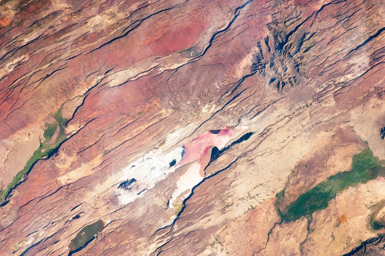
Definition
A rift valley is a long, low-lying trough that forms where the Earth's crust is being pulled apart along a divergent tectonic boundary. As the crust stretches, it thins and eventually fractures along roughly parallel fault lines, allowing the central block of crust between them to drop relative to the land on either side. Rift valleys can be relatively modest in scale or, in the most active cases, mark the early stages of a continent beginning to split apart entirely.
How It Forms
Rift valley formation unfolds as a direct consequence of tectonic plates moving apart rather than colliding.
- Tectonic forces begin pulling the crust apart.
Deep mantle processes create tension that pulls the crust in opposite directions at a divergent boundary, whether between two separating continental plates or along a mid-ocean ridge.
- The crust stretches and thins.
As the crust is pulled apart, it stretches and becomes thinner than the surrounding, undisturbed crust, weakening its structure.
- Parallel faults develop.
The weakened, stretched crust fractures along roughly parallel fault lines, creating boundaries between the central section and the land on either side.
- The central block drops.
The block of crust between the parallel faults subsides relative to the surrounding land, forming the characteristic long, narrow, low-lying rift valley floor.
- Volcanic activity often follows.
Because the crust is thinned and fractured, magma from the mantle can rise more easily in rift zones, frequently producing volcanic activity alongside the structural rifting.
Formation Timescale
Rift valleys develop over millions of years as tectonic plates move apart at typically just a few centimeters per year. Some rifts stabilize after a period of activity without ever fully separating into distinct plates, while others, given enough time, can widen into a new ocean basin as the two sides continue to separate; the East African Rift is often cited as a system that may eventually follow this path, though scientists continue to study exactly how and when that might occur, and estimates vary. Because rifting is an ongoing, active process in some regions, a rift valley's final form is not necessarily set at any particular point.
Main Characteristics
- Long, narrow, linear shape: rift valleys typically extend much further in one direction than the other, tracing the underlying fault system.
- Parallel bordering fault scarps: raised land or steep escarpments often flank both sides of the dropped central valley.
- Associated volcanic activity: many active rift zones include volcanoes fed by magma rising through the thinned, fractured crust.
- Frequent seismic activity: active rifts are typically associated with ongoing earthquake activity along their bounding faults.
- Chains of lakes: in some rift systems, the low valley floor collects water to form a series of elongated lakes along its length.
Materials and Structures Involved
Rift valley floors often expose a mix of sedimentary material that has accumulated within the subsided basin and volcanic rock, especially basalt, erupted through the thinned crust. The bordering escarpments frequently expose older crustal rock that has been uplifted relative to the valley floor as part of the same faulting process. Over time, sediment eroded from the surrounding uplifted terrain can fill parts of the rift basin, sometimes burying the original volcanic and fault features beneath newer deposits. In some rift basins, this accumulated sediment can reach considerable thickness, preserving a long, detailed record of the rifting process and the environments that existed within the valley at different points in its history.
Climates and Environments
Because rift valleys can span a wide range of latitudes and elevations, their climate varies considerably by location. The East African Rift, for example, crosses both relatively arid lowland sections and higher-elevation areas with cooler, wetter conditions. Rift valley lakes often support distinctive, sometimes highly specialized ecosystems due to their isolation and particular water chemistry, especially in volcanically influenced basins with unusual mineral content. The combination of varied elevation, volcanic soil, and isolated lake basins found along many rifts has also made these regions notable sites for the evolution of unique, localized plant and animal species found nowhere else.
Real Examples
The East African Rift is one of the most extensively studied active rift systems in the world, stretching across multiple countries and associated with significant volcanic activity, including several active volcanoes. The Rhine Rift Valley in Europe is a largely inactive rift that formed tens of millions of years ago and is now a significant agricultural and settlement area. The Baikal Rift Zone in Siberia contains Lake Baikal, the deepest lake in the world, filling a rift basin that continues to slowly widen. The Rio Grande Rift in North America is a less dramatic but still active rift system running through the southwestern United States.
How It Continues to Change
Active rift zones continue to widen gradually as tectonic plates keep moving apart, accompanied by ongoing earthquake activity and, in many cases, continued volcanic eruptions. Where rifting has stopped, as in Europe's Rhine Rift Valley, the landform persists as a dormant structural feature, no longer actively widening but still clearly recognizable in the landscape. In the most active rift systems, scientists continue to monitor ground movement closely to better understand how the rifting process might progress in the future.
Monitoring tools such as satellite-based positioning have allowed researchers to measure the rate of separation across active rifts directly, confirming that some sections of the East African Rift are widening by a small number of millimeters each year. While this is far too slow to notice without precise instruments, it is consistent over long enough periods to account for the scale of rifting visible in the landscape today. Researchers also use patterns of earthquake activity along rift-bounding faults to identify which sections of a rift system remain most tectonically active.
How It Differs From Similar Formations
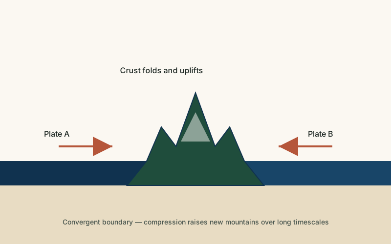
Rift valleys are sometimes mistaken for ordinary river valleys, but the two form through entirely different mechanisms: a river valley is carved by flowing water, while a rift valley results from the crust itself stretching and dropping along fault lines, often before any significant river system develops within it. Rift valleys are also related to, but distinct from, the broader uplift that creates mountains, since rifting involves crust pulling apart and subsiding rather than compressing and rising, even though the escarpments bordering a rift can look mountain-like.
Common Misconceptions
Misconception: Rift valleys are carved by rivers, like ordinary valleys.
Reality: A rift valley's basic shape comes from tectonic faulting and subsidence; rivers may later flow through the resulting low ground but did not create the valley itself.
Misconception: All rift valleys eventually become oceans.
Reality: Only some rifts continue widening long enough to form new ocean basins; many stabilize or become inactive well before reaching that stage.
Misconception: Rifting is a sudden, dramatic event.
Reality: Rift valley formation is a gradual process unfolding over millions of years, even though it is punctuated by individual earthquakes and eruptions that can be sudden and dramatic on their own.
Key Terms
- Divergent Boundary — A location where two tectonic plates move apart, allowing magma to rise and new crust to form, as in rift valleys and mid-ocean ridges.
- Fault — A fracture in the Earth's crust along which blocks of rock have moved relative to one another.
- Tectonic Plate — One of the large, rigid sections of Earth's lithosphere that move slowly over the mantle below.
- Escarpment — A steep slope or cliff that marks a sharp change in elevation, often separating two relatively flat areas.
- Basalt — A dark, fine-grained volcanic rock formed from rapidly cooled lava, rich in iron and magnesium.
- Mantle — The thick layer of hot, slowly flowing rock between the Earth's crust and its core, whose movement drives plate tectonics.