Definition
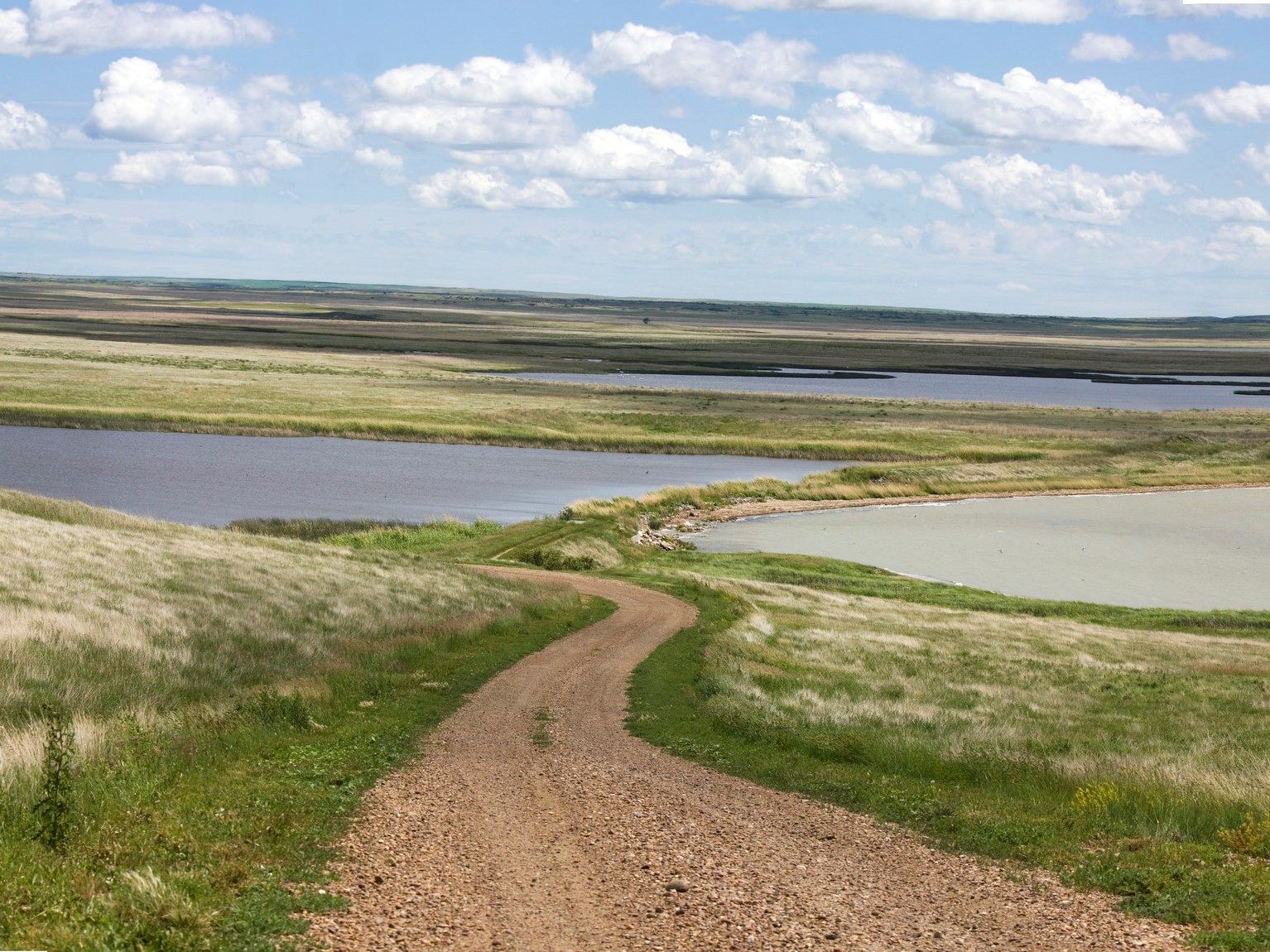
A plain is a large expanse of land with relatively little variation in elevation, generally flat or gently rolling, and typically lower-lying than the mountains, hills, or plateaus that may border it. Plains are among the most widespread landform types on Earth and occur through several different, unrelated processes that happen to produce a broadly similar low-relief result. What they share is not a single origin but an outcome: a lack of the significant elevation change that defines mountains, canyons, or plateaus.
How It Forms
Plains form through at least three distinct mechanisms, and large plain regions sometimes combine more than one over their geological history.
- Sediment deposition builds up flat land.
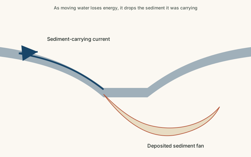
Rivers, wind, and, in some regions, retreating glaciers, deposit vast quantities of sediment over long periods. As this material accumulates and spreads out evenly, it builds a broad, flat depositional plain.
- Erosion wears down older high terrain.
Where a region has been tectonically stable for a very long time, ongoing erosion can gradually wear down what was once higher or more varied terrain into a smoother, lower-relief erosional plain.
- Repeated lava flows create a flat volcanic surface.
In some regions, successive eruptions of fluid lava spread across the land and cool into flat layers, building a plain from volcanic rock rather than sediment or erosion.
- Wind-blown dust adds fine, fertile material.
In some of the world's most productive agricultural plains, wind has deposited thick layers of fine silt, called loess, which builds up gradually and contributes to unusually fertile soil.
- The surface stabilizes into a broad, low-relief landscape.
Whichever process dominates, the long-term result is a wide area where elevation changes gradually, if at all, over large horizontal distances.
Formation Timescale
Large plains typically develop over long periods, often tens of thousands to millions of years, and the exact pace depends heavily on which formation process dominates. Depositional plains built by major rivers or retreating glaciers can accumulate substantial thickness over just tens of thousands of years in geologically active sediment systems, while erosional plains carved down from ancient uplands may represent hundreds of millions of years of slow, continuous erosion. Because multiple processes often contribute to a single plain region over its history, assigning one precise age to "the plain" as a whole is often misleading.
Main Characteristics
- Low relief: elevation changes gradually or not at all across large horizontal distances.
- Extensive horizontal scale: plains often cover enormous areas, sometimes spanning multiple countries.
- Deep, often fertile soils: many plains, especially depositional and loess-covered ones, support unusually productive agricultural soil.
- Well-developed drainage networks: rivers crossing plains often form broad, meandering channels rather than confined canyons.
- Minimal bedrock exposure: plains are frequently covered by a thick layer of loose sediment rather than exposed solid rock.
Materials and Structures Involved
Depositional plains are typically covered by thick layers of alluvium (river-deposited sediment), glacial till left by past ice sheets, or wind-blown loess, often reaching significant depth above the underlying bedrock. Volcanic plains are built from layered basalt, similar in composition to volcanic plateaus but generally at lower overall elevation. Erosional plains expose whatever bedrock underlies the region once overlying material has worn away, which can vary widely from ancient crystalline rock to sedimentary layers depending on the specific region's geological history. Loess deposits in particular can reach tens of meters in thickness in some regions, forming soil that is both unusually fertile and, because it is only loosely held together, notably prone to erosion once vegetation cover is disturbed.
Climates and Environments
Plains occur across virtually every climate zone, from the temperate Great Plains of North America to the semi-arid Pampas of South America and the cold West Siberian Plain in Asia. Because plains lack the elevation changes that create localized climate variation seen in mountains, their climate tends to be more uniform across large areas, strongly influenced instead by latitude and distance from oceans. Many of the world's plains, particularly those with fertile loess or alluvial soils, are also among its most important agricultural regions.
Real Examples
The Great Plains of North America is a vast depositional and erosional plain built from sediment eroded off the Rocky Mountains, now supporting extensive agriculture. The North European Plain stretches across much of northern Europe and includes substantial areas shaped by past glacial deposition. The Pampas in Argentina and Uruguay is a fertile plain built significantly from wind-deposited loess over an older sediment base. The West Siberian Plain in Russia is one of the largest plains on Earth, built on a thick sequence of sediment within an ancient, geologically stable basin. Despite their shared flatness, each of these plains has a distinct geological history behind it.
How It Continues to Change
Plains continue to change as rivers shift their courses, erode and redeposit sediment, and occasionally flood, gradually adding new layers to depositional plains. In regions with less vegetation or agricultural management, wind erosion can also measurably reshape plain surfaces, as seen historically in events like the 1930s Dust Bowl on the North American Great Plains, when poor land management combined with drought to strip away large amounts of topsoil. Over much longer timescales, continued tectonic stability allows erosional plains to keep smoothing out any remaining relief.
Agricultural practices introduced since that period, including planting windbreaks and using soil conservation techniques, have reduced the risk of similarly severe wind erosion on many cultivated plains, though drought and land management remain closely linked risk factors in semi-arid plain regions worldwide. Plains that depend on river deposition for soil fertility can also be affected when upstream dams or diversions reduce the sediment reaching them.
How It Differs From Similar Formations
Plains are closely related to floodplains, but a floodplain specifically refers to the low-lying land immediately bordering an active river channel that floods periodically, while a plain is a much broader regional landform that may contain many floodplains within it. Plains differ from plateaus mainly in elevation and boundary: a plateau sits distinctly higher than its surroundings with a bordering escarpment, while a plain is typically at lower elevation without such a sharp edge. Compared to deserts, which are defined by climate, a plain is defined by its shape and can occur in a desert, temperate, or virtually any other climate.
Common Misconceptions
Misconception: All plains form the same way.
Reality: Plains can form through sediment deposition, long-term erosion of older terrain, volcanic lava layering, or wind-blown dust accumulation — genuinely different processes that happen to produce similarly flat landscapes.
Misconception: Plains are geologically inactive, unchanging land.
Reality: Many plains are still actively receiving new sediment, eroding, or being reshaped by wind and water, even though the changes are often subtle compared to more dramatic landforms.
Misconception: Plains are always perfectly flat.
Reality: Most plains have gentle rolling relief rather than being perfectly level, and some contain significant local variation despite being classified as plains overall.
Key Terms
- Deposition — The process by which sediment carried by wind, water, or ice is laid down and accumulates in a new location.
- Alluvium — Loose sediment — clay, silt, sand, or gravel — deposited by flowing water, typically in riverbeds, floodplains, and deltas.
- Loess — A fine, wind-blown silt deposit that forms fertile, easily eroded soil in some plains regions.
- Erosion — The wearing away and removal of rock, soil, or sediment by natural forces such as water, wind, or ice.
- Sedimentary Rock — Rock formed from the compaction and cementation of accumulated sediment over time.
- Drainage Basin — The area of land where all surface water, from rainfall to streams, drains to a common river or outlet.