Definition
A wetland is an area of land where the soil is saturated with water either permanently or for a significant part of the year, supporting plant and animal life specifically adapted to these waterlogged conditions. Wetlands include a wide range of specific environments — marshes, swamps, bogs, and fens among them — distinguished mainly by their vegetation type and water chemistry, but unified by the underlying condition of sustained saturation. Wetlands occur at the transition between fully dry land and open water, and exactly where that boundary falls can shift considerably with the seasons.
How It Forms
Wetlands form wherever a combination of water supply, drainage conditions, and topography traps water at or near the surface for extended periods.
- Water collects in a low-lying or poorly drained area.
Flat terrain, a shallow depression, or a naturally poorly draining soil type allows water from rainfall, rivers, or groundwater to accumulate rather than running off quickly.
- Saturation becomes persistent.
Once the soil remains saturated for a long enough portion of the year, it begins to develop the distinct chemical and biological conditions associated with wetland soils, including low oxygen levels below the surface.
- Water-adapted vegetation establishes itself.
Plant species tolerant of saturated, low-oxygen soil, such as reeds, mangroves, or sphagnum moss depending on the specific wetland type, begin to dominate the area.
- Organic material and sediment accumulate.
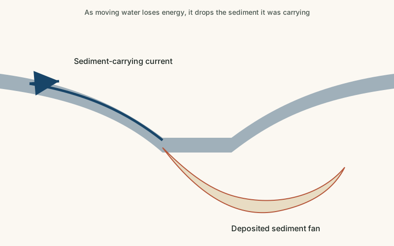
Decaying plant material and incoming sediment build up over time, sometimes forming thick layers of peat in bog environments or nutrient-rich mud in marshes and swamps.
- The wetland's extent shifts with water supply.
Seasonal flooding, tidal cycles, or changes in groundwater level cause many wetlands to expand and contract significantly throughout the year rather than maintaining a fixed boundary.
Formation Timescale
Wetlands can begin to establish within years to decades once the right hydrological conditions are in place, but their most mature features — thick peat deposits in a bog, for instance — often take thousands of years to accumulate. Because wetlands are closely tied to current water supply and drainage patterns, they can also disappear relatively quickly, within decades, if those conditions change significantly, whether through natural shifts in river course or human drainage and development.
Main Characteristics
- Persistently saturated soil: the defining feature of a wetland, present for at least part of every year.
- Specialized, water-tolerant vegetation: wetland plants are adapted to low-oxygen, saturated root conditions in ways ordinary land plants are not.
- High biological productivity: wetlands are frequently among the most productive ecosystems on Earth per unit area.
- Variable water boundary: the exact extent of standing or saturated water often shifts seasonally or with tidal cycles.
- Organic-rich soil or peat: accumulated plant material often builds up in wetland soils far more than in better-drained land.
Materials and Structures Involved
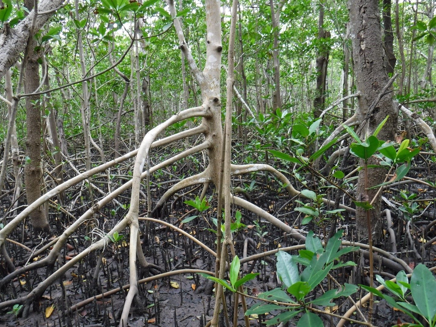
Wetland substrates vary by type: marshes typically sit on mineral-rich mud and silt, often replenished by river or tidal sediment, while bogs are dominated by thick, slowly accumulating layers of partially decomposed plant material known as peat, which forms because waterlogged, low-oxygen conditions slow decomposition dramatically. Mangrove swamps, found in tropical and subtropical coastal wetlands, develop around the root systems of salt-tolerant trees that themselves help trap additional sediment. Peat in particular can accumulate to considerable depth over thousands of years, making some bogs valuable scientific archives of past vegetation and climate conditions preserved within their slowly built-up layers.
Climates and Environments
Wetlands form in virtually every climate, from tropical mangrove swamps to cold northern peat bogs, as long as local topography and water supply allow saturation to persist. Coastal wetlands are also strongly shaped by tidal cycles and, in some cases, a mix of fresh and salt water, creating distinct brackish conditions that support specially adapted plant and animal communities. Many wetlands play an outsized role in their regional environment, filtering water, buffering flooding, and supporting disproportionately large populations of wildlife relative to their size.
Real Examples
The Pantanal, spanning parts of Brazil, Bolivia, and Paraguay, is one of the largest tropical wetlands in the world, shaped by seasonal flooding from nearby rivers. The Everglades in Florida is a vast, slow-moving freshwater wetland system sometimes described as a very wide, shallow river. The Sundarbans, spanning Bangladesh and India, is the largest mangrove forest in the world, shaped by the combined sediment of several major rivers meeting the sea. The Okavango Delta in Botswana forms a large inland wetland where a river empties into a dry basin rather than the ocean. Each of these wetlands supports a distinct set of species adapted specifically to its particular combination of water source, salinity, and seasonal cycle.
How It Continues to Change
Wetlands are highly responsive to changes in their water supply. Seasonal wetlands expand dramatically during wet periods and contract or dry out during drier months, while longer-term changes in rainfall, river management, or sea level can permanently shift a wetland's extent. Many of the world's wetlands have also been significantly reduced by drainage for agriculture and development, which has prompted substantial restoration efforts in some regions once the ecological and flood-control value of wetlands became better understood.
Coastal wetlands face an additional pressure from rising sea levels, which can shift the balance between fresh and salt water and, in some cases, submerge marsh or mangrove habitat faster than sediment and vegetation can build the surface back up. Inland wetlands, by contrast, are often more sensitive to changes in upstream water management, since dams, irrigation, and groundwater pumping can all reduce the water supply a wetland depends on even without any direct physical disturbance to the site itself.
How It Differs From Similar Formations
Wetlands overlap substantially with river deltas, since many deltas are themselves extensive wetland environments, though not every wetland is associated with a delta. They are also closely related to floodplains, which may contain wetland areas during flood periods but are not necessarily saturated year-round. Compared to a permanent lake or pond, a wetland is distinguished by shallow, often seasonal water combined with saturated soil and specifically adapted vegetation, rather than a consistently deep, open body of water.
Common Misconceptions
Misconception: Wetlands are useless, stagnant swampland.
Reality: Wetlands are frequently among the most biologically productive environments on Earth and provide significant flood control and water filtration benefits.
Misconception: A wetland is always visibly covered in standing water.
Reality: Many wetlands have fluctuating water levels and can appear largely dry at the surface during parts of the year while remaining classified as wetlands due to their soil and vegetation.
Misconception: All wetlands are freshwater.
Reality: Coastal wetlands, including many mangrove swamps and salt marshes, involve brackish or saltwater conditions shaped significantly by tides.
Key Terms
- Sediment — Solid material — fragments of rock, mineral grains, or organic matter — that is transported and deposited by water, wind, or ice.
- Water Table — The upper surface of the saturated zone underground, below which all pore spaces are filled with water.
- Groundwater — Water that exists beneath the Earth's surface in the cracks and pore spaces of soil and rock.
- Floodplain — The flat land bordering a river that is periodically covered by water during floods and built up by deposited sediment.
- Deposition — The process by which sediment carried by wind, water, or ice is laid down and accumulates in a new location.